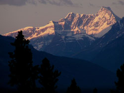
Photo: Looking south 43 km up the Athabasca River Valley to Mount King Edward from Highway #93 at the Ranger Hill Viewpoint
Mount King Edward
- 3490 m (11,451ft)
- First Ascent
- Naming History
Located on the continental divide at the head of the Athabasca River Valley; 5.5 km west of Mount Columbia
Province: Alberta/BC
Park: Jasper
Headwater: Athabasca/Columbia
Major Valley: Athabasca
Visible from Highway: 93N
Ascent Party: J.W.A. Hickson, Howard Palmer
Ascent Guide: Conrad Kain
Named by: Mary Schaffer
Named for: King Edward (King Edward became the King of England in 1901.)
Note that there is also a King Edward Peak. 'In Volume I of the Interprovincial Boundary Survey, Arthur Wheeler described the Royal Group as, "a very remarkable group of mountains comprising seven distinct peaks, the highest having a altitude of 11,226 fee; it is much in evidence, and its towers and precipitous walls, its glaciers and outlying ridges dominate the landscape from all directions. It was first noticed by the Topographical division from Wonder Peak, close to Mount Assiniboine, and the name of "Mt. King George" was then given to the highest summit. The Commissioners now suggest that the title of 'The Royal Group' be applied to this collection of peaks and that the names of the Royal Family be placed upon its several summits. . ." The first and second ascents of this peak were made 52 years apart.
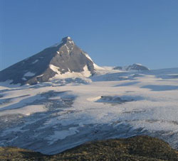
Looking north to Mount King Edward from the edge of the Columbia Icefield, directly west of Mount Columbia (courtesy Dan Ronsky)
Mount King Edward (courtesy Alan Kane)
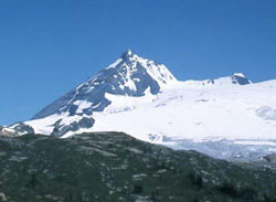
Looking east to Mount King Edward (courtesy Alan Kane)
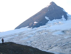
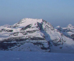
Looking north to Mount King Edward from the edge of the Columbia Icefield, directly west of Mount Columbia (courtesy Dan Ronsky)