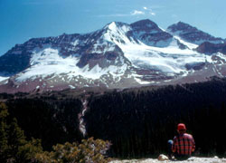
Photo: The Vice President (left) and The President (right) from the north at the Whaleback Trail summit (courtesy Dr. John D. Birrell)
The President
- 3138 m (10,296ft)
- First Ascent
- Naming History
- Hiking and Trails
Located north of Emerald Lake and south of the Little Yoho Valley; western buttress of President Pass; eastern buttress of Emerald Pass
Range: President
Province: BC
Park: Yoho
Headwater: Columbia
Visible from Highway: 1
Ascent Party: James Outram
Ascent Guide: J. Pollinger, C. Kaufmann
Named by: Alpine Club of Canada
Named for: Edmund Whymper named The President in honour of the CPR's president, Thomas Shaughnessy and The Vice President in honour of its vice-president, David McNicoll.
Journal Reference: AJ 20-541; App 10-86
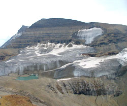
The high peaks of the President Range dominate the view at the head of Emerald Basin, a high valley beyond Emerald Peak and to the north of Emerald Lake. As well, the President and neighbouring The Vice President are the most prominent mountains seen from the Little Yoho Valley. The ice-covered summit of the President is 136 metres higher than the Vice President which is covered by the extensive Emerald Glacier. The high col connecting the two is known as President Pass. Edward Whymper, of Matterhorn fame, was one of the first to explore the area of Yoho Park to the north of the railway. He travelled to Canada as the guest of the Canadian Pacific Railway and in 1904, perhaps as a thank you, named The President after the railway?s president, Thomas Shaughnessy and The Vice President after its vice-president, David McNicoll. In 1901 James Outram, led by guides Christian Kaufmann and James Pollinger, completed a traverse of the President Range from The President to Michael Peak, completing the first ascents of the President and Vice President. At that time The President was known as Emerald Mountain and Michael Peak as Angle Peak.
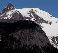
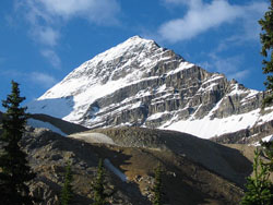
Photo: Looking north to The President from the Emerald Lake Road (What appears to be a sharp peak at left is merely the end of the ridge that descends from the summit of The President.)
Looking north-northwest to The President from Mount Burgess (courtesy Sonny Bou)
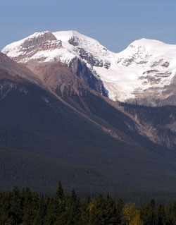
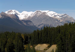
Looking north to The President (left) and The Vice President from the Trans-Canada Highway
Looking north to The President Range from the Trans-Canada Highway near Ottertail Creek
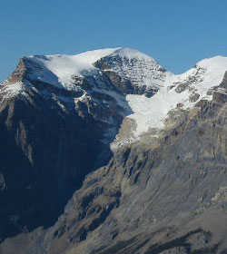
Looking southwest to The President from the Iceline Trail (courtesy Sonny Bou)
Looking east to The President from Mount Kerr (courtesy Sonny Bou)
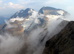
Looking southeast to The Vice President (left) and The President (courtesy Sonny Bou)