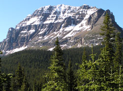
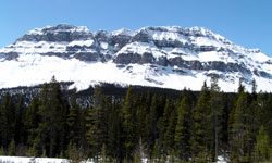
Photo: Looking south to Bow Peak from the Icefields Parkway
Bow Peak
- 2868 m (9,410ft)
- Naming History
Located in the Bow River Valley between Hector Lake and Bow Lake; east buttress of Crowfoot Pass
Province: Alberta
Park: Banff
Headwater: Bow
Major Valley: Bow
Visible from Highway: 1, 93N
Named for: The mountain is very near the headwaters of the Bow River which was referred by the Cree Indians as "The place from which bows are taken."
Goat Mountain was the name that James Hector gave to what is now known as Bow Peak. The name also appears on George Dawson's 1886 map. The mountain extends to the east from the main Waputik Range, dividing the basin containing Hector Lake to the south from that containing Bow Lake to the north. Its smoothly contoured western slopes descend into Crowfoot Pass which features beautiful snow patches until well into the summer. Although not particularly high, the peak is a conspicuous landmark, visible from the Lake Louise area as well as from as far north as the Sunwapta Pass area.
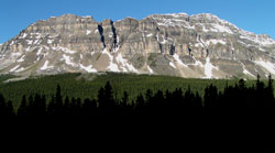
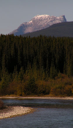
Photo: Looking southwest to Bow Peak from the Icefields Parkway
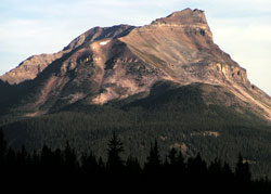
Looking north-northwest to Bow Peak from the Icefields Parkway
Looking north-northwest to Bow Peak from the Icefields Parkway
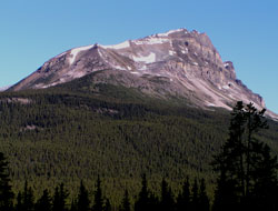
Looking southwest to Bow Peak from the Icefields Parkway
Looking northwest to Bow Peak from the Lipalian Mountain Viewpoint on the Trans-Canada Highway