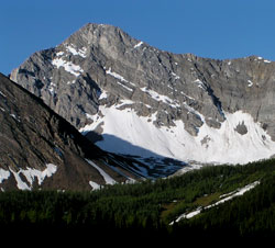
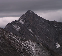
Photo: Looking southwest to Mount Tyrwhitt from just north of Highwood Pass on Highway #40
Mount Tyrwhitt
- 2874 m (9,430ft)
- First Ascent
- Naming History
Located on the continental divide at the head of Pocaterra Creek; east buttress of Elk Pass; west buttress of Grizzly Col
Range: Elk
Province: Alberta/BC
Park: Kananaskis
Headwater: Bow/Kootenay
Visible from Highway: 40S
Ascent Party: Horace "Rusty" Westmorland, Alan Campbell
Ascent Guide: Conrad Kain
Named for: Tyrwhitt, Rear Admiral Sir Reginald Y. (Rear Admiral Tyrwhitt commanded destroyer flotillas during WW I.)
Mount Tyrwhitt occupies a very significant point on the Continental Divide in that it is from its summit that the BC/Alberta boundary leaves the Elk Range and descends into Elk Pass, following a generally ENE-WSW trend for fifteen kilometres until reaching the summit of Mount Joffre. John Palliser's map showed Mount Head to be situated at the point that is now referred to as Mount Tyrwhitt. The east ridge of the mountain features a spectacular rock arch which is visible from Highway #40 from a point just north of Highwood Pass. In the upper photograph, the "window" appears as a tiny dot of white below what appears to be a small pinnacle half way up the left hand ridge of the mountain. It is interesting to note that in 1914 one of the most highly respected of the early guides in the Canadian Rockies, Conrad Kain, was the first to climb Mount Tyrwhitt. His party included Horace "Rusty" Westmorland and Alan Campbell (Land Surveyor) and was part of the Interprovincial Boundary Survey. Although a camera station on the summit was not occupied until 1915, Alan Campbell led a reconnaissance survey to the Elk Pass area in June, 1914 and it must have been during this time that the mountain was first climbed. [Adventures In Climbing, Rusty Westmorland. Pelham Books, London, 1964] Lindsay Elms
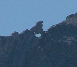
Photo: The "window" on the east ridge of Mount Tyrwhitt
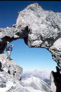
The window on Mount Tyrwhitt (courtesy Alan Kane)
Looking southwest to Mount Tyrwhitt from just north of Highwood Pass on Highway #40
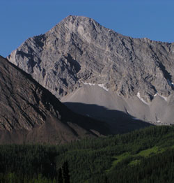
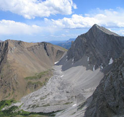
Looking south to Mount Tyrwhitt from Pocaterra Ridge
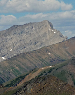
Looking south-southeast to Mount Tyrwhitt (at left) from Mount Pocaterra (courtesy Sonny Bou)
Looking northwest to Mount Tyrwhitt from Mount Lipsett