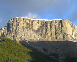
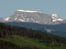
Photo: Looking northwest to Mount Romulus from the Little Elbow Valley (courtesy Sonny Bou)
Mount Romulus
- 2832 m (9,292ft)
- Naming History
Located in the Little Elbow River Valley south of Shoulder Creek
Range: Fisher
Province: Alberta
Park: Kananaskis
Headwater: Bow
Visible from Highway: 546
Named for: Romulus and Remus were the legendary founders of Rome.
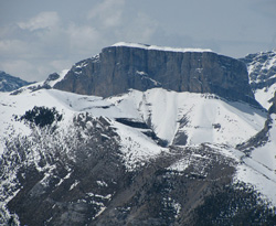
The block shaped Mount Romulus lies just to the west of its lower neighbour, Mount Remus. Both mountains lie to the north of the Little Elbow River, just across the valley from Mount Glasgow. The steep, east facing cliffs of Mount Romulus always remain snow-free. However they cause a large cornice of snow to form along the east (lee) side of the cliff tops. This results in a near-horizontal white line of snow that, because it tends to accumulate through the winter, becomes quite thick and lasts for some time after the warm weather arrives. Very distinctive when viewed from the foothills and plains, it remains well into the late spring. Romulus and Remus were the legendary founders of Rome. Twin sons of Mars and Rhea Silvia, they were abandoned and cast adrift on the Tiber, ultimately washing ashore where they were suckled by a wolf and fed by a woodpecker. They were then adopted by a shepherd and later founded the city that was to become Rome. Romulus surrounded it with a wall, but Remus in contempt jumped over it so Romulus killed him and reigned alone in the city which was named for him.
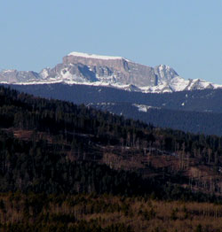
Photo: Looking southwest to Mount Romulus from Highway #22, 2 km east of the junction with Highway #66
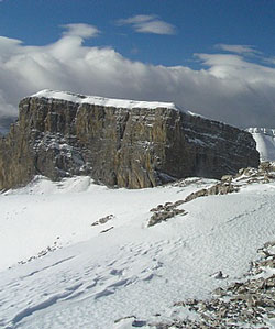
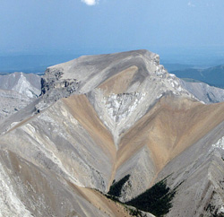
Looking west-southwest to Mount Romulus from Mount Remus (courtesy Vern De Wit)
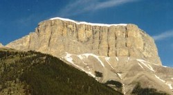
Looking northwest to Mount Romulus from the Little Elbow Valley
Looking west-southwest to Mount Romulus from Highway #66
Looking east to Mount Romulus (courtesy Sonny Bou)
Looking west to Mount Romulus from Forget-me-not Ridge (courtesy Sonny Bou)