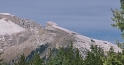
Photo: Mount Remus from the southeast; Mount Romulus is beyond and to the left (courtesy George Brindle)
Mount Remus
- 2688 m (8,819ft)
- Naming History
Located in the Little Elbow River Valley, 2 km east/northeast of Mount Romulus; west of Nihahi Creek; south of Shoulder Creek
Range: Fisher
Province: Alberta
Park: Kananaskis
Headwater: Bow
Visible from Highway: 546
Named for: Romulus and Remus were the legendary founders of Rome.
The block shaped Mount Romulus is the northernmost peak seen from the Priddis area. Its lower neighbour, Mount Remus, lies just in front of it and is difficult to identify from the foothills and prairies. Both mountains are just to the north of the Little Elbow River, just across the valley from Mount Glasgow. Romulus and Remus were the legendary founders of Rome. Twin sons of Mars and Rhea Silvia, they were abandoned and cast adrift on the Tiber, ultimately washing ashore where they were suckled by a wolf and fed by a woodpecker. They were then adopted by a shepherd and later founded the city that was to become Rome. Romulus surrounded it with a wall, but Remus in contempt jumped over it so Romulus killed him and reigned alone in the city which was named for him.
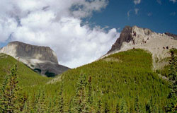
Photo: Mount Romulus (left) and Mount Remus from the southeast (courtesy Bennett Wong)
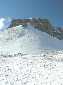
Looking west-southwest to Mount Remus (courtesy Vern De Wit)