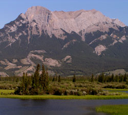
Photo: Looking west to Roche Ronde from Highway #16
Roche Ronde
- 2138 m (7,015ft)
Located in the Athabasca River Valley west of Ronde Creek
Range: Bosche
Province: Alberta
Park: Jasper
Headwater: Athabasca
Major Valley: Athabasca
Visible from Highway: 16
"Ronde" means round in French. Lying across the river from Roche Miette, the reason for its name is apparent when the mountain is seen from the Disaster Point Viewpoint. The legendary Snake Indian River flows from the north-west, just beyond Roche Ronde to join the Athabasca River. In pre-photography days visitors were, at times, prone to writing "a thousand words." Reverend Grant wrote of the view, "Roche Ronde was to our right, its stratification as distinct as the leaves of a half opened book. The mass of the rock was limestone, and what at a distance had been only peculiarly bold and rugged outlines, were now seen to be the different angles and contortions of the strata. And such contortions! One high mass twisting up the sides in serpentine folds; another bent in great waving lines, like petrified billows. The colouring, too, was all that artist could desire. Not only the dark green of the spruce in the corries, which turned into black when far up, but autumn tints of red and gold as high as vegetation had climbed on the hill sides; and above that, streaks and patches of yellow, green, rusty red and black, relieving the gray mass of limestone; while up the valley, every shade of blue came out according as the hills were near or far away, and summits hoary with snow bounded the horizon."
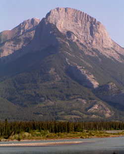
Photo: Looking north-northwest to Roche Ronde from Disaster Point on Highway #16
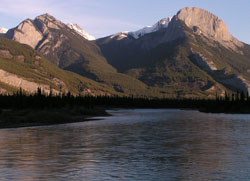
Looking north-northwest to Roche a Bosche (left) and Roche Ronde
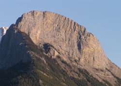
Looking northwest to the summit block Ronde