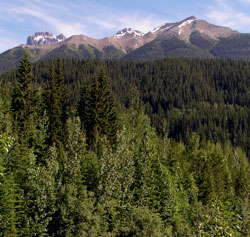
Photo: Looking north to Mount Mowat from Highway #16 at Grant Brook
Mount Mowat
- 2843 m (9,328ft)
- First Ascent
- Naming History
52.9417N -118.733W
Located in the Fraser River Valley west of Grant Brook
Province: BC
Park: Mount Robson
Headwater: Fraser
Major Valley: Fraser
Visible from Highway: 16
Located in the Fraser River Valley west of Grant Brook
Province: BC
Park: Mount Robson
Headwater: Fraser
Major Valley: Fraser
Visible from Highway: 16
Ascent Date: 1911
Ascent Party: G.B. Kinney, Arthur Wheeler
Ascent Guide: Conrad Kain
Ascent Party: G.B. Kinney, Arthur Wheeler
Ascent Guide: Conrad Kain
Year Named: 1912
Named by: Topographical Survey
Named for: Mowat, Sir Oliver (One of the Fathers of Confederation, Mowat was a Premier of Ontario and later became Lt. Governor.)
Named by: Topographical Survey
Named for: Mowat, Sir Oliver (One of the Fathers of Confederation, Mowat was a Premier of Ontario and later became Lt. Governor.)
Arthur Wheeler, the most prominent of the early surveyors of the Canadian Rockies and one of the founders of the Alpine Club of Canada, wrote that he named this mountain after Sir Oliver Mowat (who had served as premier of Ontario 1872-1896), "...owing to a striking resemblance to his well-known features, when seen in profile from the Fraser Valley near the Junction of Grant Brook." Wheeler didn't say what Mowat's "well-known features" were. To me, the high point of the mountain looks like a head lying horizontally with very prominent "mutton chops" which Oliver Mowat had. Mount Mowat was first climbed in 1911 by George Kinney and Arthur Wheeler, guided by Conrad Kain.