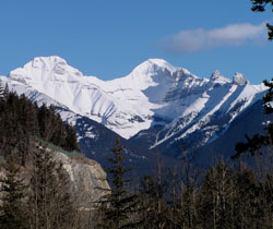
Photo: Mount Inglismaldie (left) and Mount Girouard from the Trans-Canada Highway at the Vermilion Lakes Viewpoint
Mount Girouard
- 2995 m (9,827ft)
- First Ascent
- Naming History
Located in the Bow River Valley south of Lake Minnewanka; 1.5 km east-southeast of Mount Inglismaldie
Range: Fairholme
Province: Alberta
Park: Banff
Headwater: Bow
Major Valley: Bow
Visible from Highway: 1
Ascent Party: E.E. Bishop, D.R. Crosby
Named for: Girouard, Colonel Sir Edward Percy (After serving as a railway builder in north and south Africa as the British Empire expanded, Col Girouard became a colonial administrator and Director General of Munitions Supply in 1915.)
Mount Inglismaldie, Mount Girouard, and Mount Peechee form a massive, interconnected group that is the northern end of the Fairholme Range lying immediately south of Lake Minnewanka. Although it is neighbouring Mount Inglismaldie that is named after a castle in Scotland, Mount Girouard features some spectacular castle-like turrets on its southwestern ridge. Colonel Sir Edward Perchy Girouard (1867-1932) graduated from the Royal Military College in Kingston, Ontario and joined the British Army Royal Engineers in 1888. He became Director of Railways for the British Forces in Sudan and was responsible for the building of a 588 mile railway across the Sudanese desert, receiving the DSO (Distinguished Service Order) following the defeat of the Sudanese. Later he was knighted for his service during the Boer War as Director of Railways. He was the first Canadian to be knighted. When World War I broke out, he re-joined the army and worked with Lord Kitchener (see Mount Kitchener). It is said that Winston Churchill regarded him as one of the most brilliant men of his times. (Lakusta)
Looking east to the southwest ridge and the summit of Mount Girouard
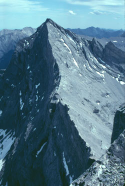
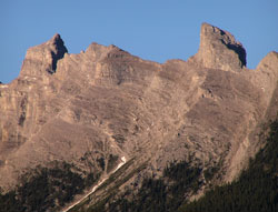
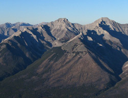
Photo: Mount Girouard from the northwest on Mount Inglismaldie (courtesy Rienk Lakeman)
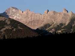
Spires along the soutwest ridge of Mount Girouard
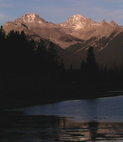
Looking to east-northeast to Mount Inglismaldie (left) and Mount Girouard from Vermilion Lakes
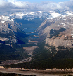
Looking west-southwest through Devils Gap. Phantom Crag is at right in the foreground. Mount Girouard (left) and Mount Inglismaldie are in the distance at right. (courtesy Roger Edgecombe)
Looking north-northeast to Mount Inglismaldie (left) and Mount Girouard from Mount Rundle (courtesy Sonny Bou)