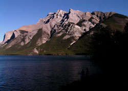
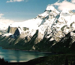
Photo: Looking east to Mount Inglismaldie from Lake Minnewanka
Mount Inglismaldie
- 2964 m (9,725ft)
- First Ascent
- Naming History
Located Bow River Valley south of Lake Minnewanka
Range: Fairholme
Province: Alberta
Park: Banff
Headwater: Bow
Major Valley: Bow
Visible from Highway: 1
Ascent Party: H. Foster, J. Packer, M.C. Wylie, Betts, Dickson, W. Innes, L. DeCouteur, J. Miskow, Sadler, Vallance
Ascent Guide: Lawrence Grassi
Named by: George A. Stewart (Superintendent of Rocky Mountain Parks)
Named for: Named after Inglismaldie Castle in Kincardineshire, Scotland which was the seat of the Earl of Kintore who was visiting Banff.
Mount Inglismaldie, Mount Girouard, and Mount Peechee form a massive, interconnected group that is the northern end of the Fairholme Range lying immediately south of Lake Minnewanka.
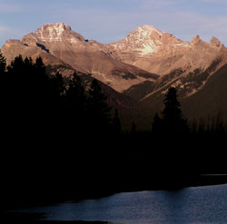
Photo: Mount Inglismaldie (left) and Mount Girouard from Vermilion Lakes

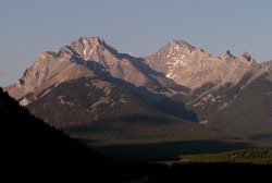
Looking east to Mount Inglismaldie (left) and Mount Girouard from Cascade Mountain (courtesy Rob Taerum)
Looking east-northeast to Mount Inglismaldie (left) and Mount Girouard from the Trans-Canada Highway near Banff
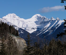
Looking east-northeast to Mount Inglismaldie (left) and Mount Girouard from the Trans-Canada Highway
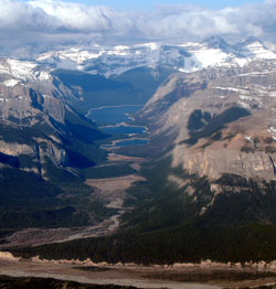
Looking west-southwest through Devils Gap. Phantom Crag is at right in the foreground. Mount Girouard (left) and Mount Inglismaldie are in the distance at right. (courtesy Roger Edgecombe)
Looking east to Mount Inglismaldie (Mount Girouard beyond in cloud) from C-Level Cirque (courtesy Calvin Damen)
Looking north-northeast to Mount Inglismaldie (left) and Mount Girouard from Mount Rundle (courtesy Sonny Bou)