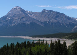
Photo: Looking south to Elliott Peak (left) and Sentinel Mountain from Highway #11
Sentinel Mountain
- 2865 m (9,400ft)
- Naming History
Located in the North Saskatchewan River Valley south of the Cline River; the peak is the northwest shoulder of Elliott Peak
Province: Alberta
Headwater: Saskatchewan
Major Valley: Saskatchewan
Visible from Highway: 11
Named by: Arthur Coleman
Named for: The mountain that formerly carried the name (now Elliott Peak) can be seen from several valleys which head towards it.
The mountain now known as Elliott Peak was referred to as Sentinel Mountain by Arthur Coleman as he descended Whiterabbit Creek in 1892. He wrote, "When we came down from Whiterabbit Creek. . . straight ahead, jutting boldly out into the belt of prairie, stood a beautiful mountain, 9000 feet high, bent into a fold like an "S", two miles long and a mile broad, tipped on its side. It can be seen from all the valleys looking into the plains, and we named it Sentinel Mountain. Coleman's book includes a photo with the caption, "Looking up Pipestone Valley from Mount Richardson in the chapter describing his 1907 trip. Sentinel Mountain may have been climbed in 1858 by James Hector. In his journals, Hector said that he climbed up a ridge that led to the top of an adjoining peak. He wrote, "The highest point that I reached was about 4300 feet above our camp at the Kootenai Plain." Please note that there is a Sentinel Peak in the Livingstone Range.
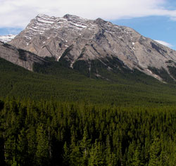
Photo: Looking south to Sentinel Mountain from Highway #11
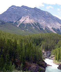
Looking south to Sentinel Mountain from the lower Cline River Valley (courtesy Sonny Bou)
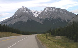
Looking south to Elliott Peak (left) and Sentinel Mountain from Highway #11
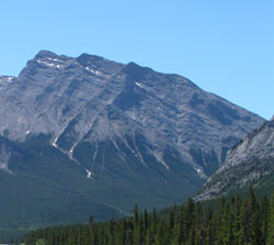
Photo: Looking south to Sentinel Mountain from Highway #11