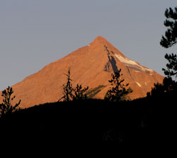
Photo: Looking southwest to morning light on Mount King from the Emerald Lake Road
Mount King
- 2892 m (9,489ft)
- First Ascent
- Naming History
51.3406N -116.649W
Located in the Kicking Horse River Valley between Ottertail River and Porcupine Creek
Range: Van Horne
Province: BC
Park: Yoho
Headwater: Columbia
Major Valley: Kicking Horse
Visible from Highway: 1
Located in the Kicking Horse River Valley between Ottertail River and Porcupine Creek
Range: Van Horne
Province: BC
Park: Yoho
Headwater: Columbia
Major Valley: Kicking Horse
Visible from Highway: 1
Ascent Date: 1892
Ascent Party: J.J. McArthur
Ascent Party: J.J. McArthur
Year Named: 1886
Named by: Otto Koltz
Named for: King, William Frederick (William King followed Klotz as Chief Astronomer of Canada and served as inspector of surveys. He was also the Canadian member of the International Boundary Commission.
Named by: Otto Koltz
Named for: King, William Frederick (William King followed Klotz as Chief Astronomer of Canada and served as inspector of surveys. He was also the Canadian member of the International Boundary Commission.
Mount King was the location of a fire lookout during the 1950's.
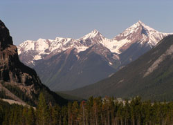
Photo: Looking southwest to Mount King (right) and lesser peaks of the Van Horne Range from Highway #1, west of Kicking Horse Pass
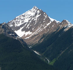
Looking southwest to Mount King from the Trans-Canada Highway
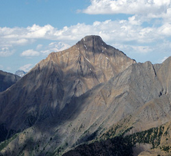
Looking northeast to Mount King from Mount Hunter (courtesy Sonny Bou)