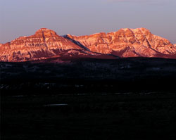
Photo: Association Peak (left) and End Mountain from Highway #1
Association Peak
- 2362 m (7,750ft)
- Naming History
51.1803N -115.126W
Located north of upper Old Fort Creek
Province: Alberta
Headwater: Bow
Visible from Highway: 1
Located north of upper Old Fort Creek
Province: Alberta
Headwater: Bow
Visible from Highway: 1
Year Named: 1967
Named for: Unknown
Named for: Unknown
To the north of Mount John Laurie lies a small, two mountain range located five km east of the main front range between the headwaters of Old Fort Creek and the South Ghost River. Association Peak is the southernmost and lower of the two, an attractive, symmetric peak which is quite noticeable from the Trans-Canada Highway but best viewed from Highway #1A. Although the name was officially approved in 1967, it had been well established long before that. The reason for its name and the association that is honoured are not known.
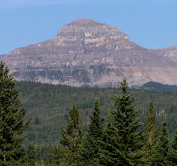
Photo: Association Peak from Highway #1A, just east of Old Fort Creek
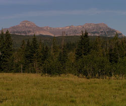
Association Peak (left) and End Mountain from Highway #1A