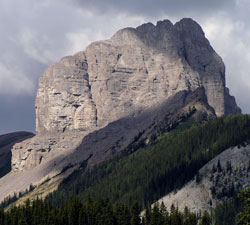
Photo: The Fist from the Smith-Dorrien Road near Commonwealth Creek
The Fist
- 2630 m (8,629ft)
- Naming History
50.8139N -115.371W
Located in the Commonwealth Creek Valley 1.5 km north of Mount Smuts
Province: Alberta
Park: Kananaskis
Headwater: Bow
Visible from Highway: 742
Located in the Commonwealth Creek Valley 1.5 km north of Mount Smuts
Province: Alberta
Park: Kananaskis
Headwater: Bow
Visible from Highway: 742
Year Named: 1973
Named by: Bernie Schiesser
Named for: The feature resembles a clenched fist.
Named by: Bernie Schiesser
Named for: The feature resembles a clenched fist.
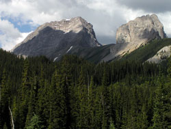
Photo: Mount Smuts (left) and The Fist from the Smith-Dorrien Road near Commonwealth Creek
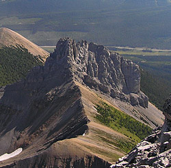
Looking east-northeast to The Fist from Mount Smuts (courtesy Vern De Wit)