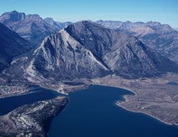
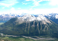
Photo: Looking northwest to Mount Crandell from Vimy Peak (courtesy Rienk Lakeman)
Mount Crandell
- 2381 m (7,812ft)
- Naming History
Located northwest of Middle Waterton Lake, south of Blakiston Creek, and northeast of Cameron Creek
Province: Alberta
Park: Waterton
Headwater: Oldman
Visible from Highway: 5, Red Rock Canyon Road
Named for: Crandell, Edward H. (A Calgary businessman, E.H. Crandell was one of the city's first "oilmen."
When the mountains in the area of Waterton Lakes were being considered as a possible national park a Department of the Interior report referred to the Wilson Range which stretches from the Belly River in the east to the Waterton Lakes. A Canadian government department, it may have been biased when it stated, "The culminating point of this range, Mount Cleveland, 10 535 feet in height is in Montana, but its most significant peak is its Canadian summit, Sheep Mountain, which though only 7580 feet high, makes up what it lacks in altitude by its situation at the angle of the Waterton Lakes." In fact, Sheep Mountain is not even part of the Wilson Range. However the significance of its location directly northwest of Waterton Townsite and the northern end of Waterton Lakes is correct. Sheep Mountain was Kootenai Brown's favourite peak. He enjoyed looking at it as well as hunting on it in the fall. Sheep Mountain was renamed Mount Crandell in 1914 after Edward Henry Crandell, a pioneer Calgary businessman and City Councillor who had an interest in the first producing oil well in western Canada, Discovery No. 1. Early visitors to southwestern Alberta had been told by Indians of oil seepages in the Waterton Lakes area and Kootenai Brown and his companion William Aldridge had noticed beads of oil floating on Cameron Creek. In 1902 John Lineham of Okotoks, Alberta formed the Rocky Mountain Development Company, shares were sold, and a drilling rig shipped from Petrolia, Ontario. The following year the roar of heavy machinery reverberated though the Cameron Creek valley just west of Mount Crandell and oil was discovered at a depth of 311 metres. In preparation for the expected boom a townsite named Oil City was cleared, steets were surveyed, and several buildings constructed. However the flow of oil came to a halt, the boom didn't materialize, and after three years of work the well was abandoned.
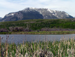
Photo: Looking west-southwest to Mount Crandell
Looking west to Mount Crandell
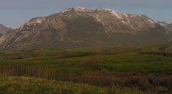
Looking southeast to Mount Crandell from near Red Rock Canyon
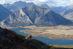
Looking south-southeast to Mount Crandell from Mount Galwey (courtesy Sonny Bou)
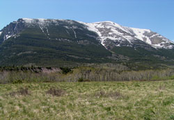
Looking west to Mount Crandell
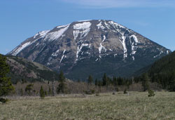
Looking southeast to Mount Crandell from near Red Rock Canyon
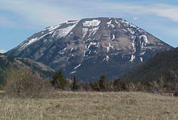
Looking west-northwest to Mount Crandell from Sofa Mountain (courtesy Sonny Bou)