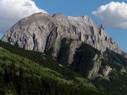
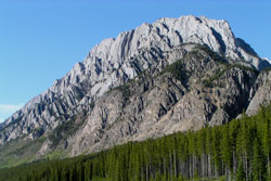
Photo: Looking southeast to Mount Wintour from Highway #40
Mount Wintour
- 2700 m (8,859ft)
- First Ascent
- Naming History
Located in the Kananaskis River Valley east of the north end of Lower Kananaskis Lake
Province: Alberta
Park: Kananaskis
Headwater: Bow
Major Valley: Kananaskis
Visible from Highway: 40S, 742
Ascent Party: Glen Boles, E. Peyer
Named for: Wintour, Captain Charles (A Royal Navy officer who served in the Battle of Jutland during WW I.)
Mount Wintour is an interesting mountain, its steep slopes cut by numerous steep drainages which create fascinating snow highlights in the spring. It's picturesque, vertical cliffs are best seen from Highway #40, just south of the junction with the Smith Dorrien Trail. Captain C. J. Wintour went down with his ship, HMS Tipperary, during the Battle of Jutland. Please see Mount Tipperary. Opal RidgeGrizzly PeakGap Mountain are part of a high ridge that lies to west of the Opal Range.
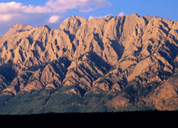
Looking east-northeast to Mount Wintour from the Interlake Campground (courtesy Gerry Hopkins)
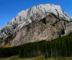
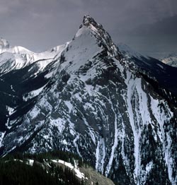
Photo: Looking north to Mount Wintour from Highway #40
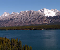
Looking north-northeast to Mount Wintour with Mount Blane (beyond at left) and through Opal Creek Valley to Mount Jerram (at right)
Looking north to Mount Wintour from Elpoca Creek on Highway #40
Looking north to Mount Wintour from King Creek Ridge (courtesy Gerry Hopkins)
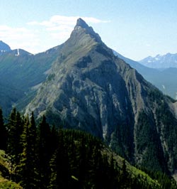
Looking north to Mount Wintour from King Creek Ridge (courtesy Gerry Hopkins)