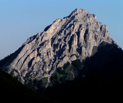
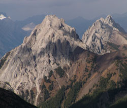
Photo: Looking north-northwest to Gap Mountain from just north of Highwood Pass
Gap Mountain
- 2667 m (8,750ft)
- Naming History
Located in the Pocaterra Creek Valley across Pocaterra Creek from the northern end of Elk Range
Province: Alberta
Park: Kananaskis
Headwater: Bow
Visible from Highway: 40S, 742
Named for: Gap Mountain was named because of its location above the "gap" between the Opal and Elk Ranges.
Highway No. 40 passes through a "gap" between the Opal Range and the Elk Range as it descends from Highwood Pass to the junction with Kananaskis Trail. Gap Mountain lies to the east of the gap. Opal Ridge, Grizzly Peak, Mount Wintour, and Gap Mountain are part of a high ridge that lies to the west of the Opal Range.
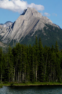
Photo: Looking southeast to Gap Mountain from the Smith-Dorrien Road
Looking southeast to Gap Mountain from the meadows near the Smith-Dorrien Junction (courtesy Gerry Hopkins)
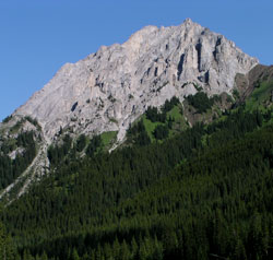
Looking north-northwest to Gap Mountain from Highway #40
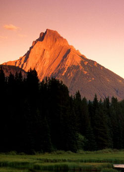
Looking to Gap Mountain (left) and Mount Wintour from Highwood Ridge

Looking north-northwest to Gap Mountain
Looking north-northwest to Gap Mountain