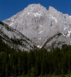
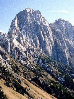
Photo: Looking east-northeast to Mount Blane from the junction of Highway #40 and Kananaskis Lakes Trail; "The Blade" at right
Mount Blane
- 2993 m (9,820ft)
- First Ascent
- Naming History
Located in the Kananaskis Valley between King Creek and the headwaters of Evan Thomas Creek
Range: Opal
Province: Alberta
Park: Kananaskis
Headwater: Bow
Visible from Highway: 40S, 742
Ascent Party: P.J.B. Duffy, G. Hohnson, D. Kennedy, F. Koch (Koch was killed by a falling rock during the ascent.)
Named for: Blane, Sir C.R. (Sir Blane served in the Royal Navy during WW I. He was lost while serving aboard HMS Queen Mary when the ship was sunk during the Battle of Jutland during WW I.)
From the junction of the Kananaskis Lakes Trail and Highway #40, the near vertically dipping beds of Mount Blane are most impressive as is a distinctive notch with an isolated summit on its southern ridge known as The Blade. The mountain may also be seen from various locations in the City of Calgary where views up the Elbow River Valley are possible. According to official government records, Mount Blane was named after Sir C.R. Blane, "commander" of the battle cruiser HMS Queen Mary which was part of Rear Admiral Brock's squadron and which was destroyed in the battle. However, the records of the Battle of Jutland indicate that C.I. Prowse was the captain of the Queen Mary and no mention is made of a C.R. Blane. It is thought that Blane was one of a number of "commanders" aboard the ship and it is known that he was killed during the Battle of Jutland. We do not know why he and not Prowse was chosen to be honoured in this way. In September, 1955 after completing the first ascent of the mountain, P.J.B. Duffy, D. Kennedy, and G. Johnson left the summit followed by the fourth member of the party, F. Koch. After descending to a narrow ledge that they had nicknamed, "The Goat Walk", Koch did not appear and the others could not find him. The next morning Koch's body was found. It appeared that he had been struck by a falling rock.
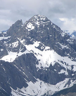
Photo: Looking southwest to Mount Blane (The Blade at left) from Mount Romulus (courtesy Sonny Bou)
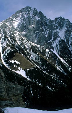
Looking north-northeast to Mount Blane from Upper Kananaskis Lake
Looking east-northeast to Mount Blane from the junction of Highway #40 and Kananaskis Lakes Trail; "The Blade" at right
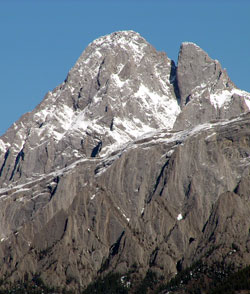
Looking southeast to Mount Blane from Grizzly Peak (courtesy Bennett Wong)
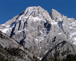
Looking southeast to Mount Blane from King Creek Ridge (courtesy Gerry Hopkins)
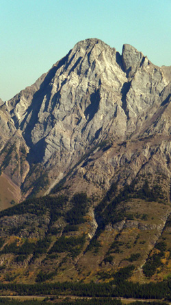
Looking northeast to Mount Blane