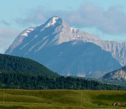
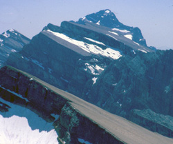
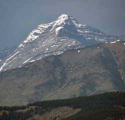
Photo: Looking west-northwest to Tornado Mountain from Highway #22 near the Oldman River Bridge
Tornado Mountain
- 3099 m (10,167ft)
- First Ascent
- Naming History
Located on the continental divide at the headwaters of Dutch Creek, Hidden Creek and Tornado Creek; east buttress of Tornado Pass;
Range: High Rock
Province: Alberta/BC
Headwater: Oldman/Kootenay
Visible from Highway: 22
Ascent Party: Interprovincial Boundary Commission
Named by: Morrison Bridgland
Named for: The mountain was named by the Interprovincial Boundary surveyors because, "Tornado Mountain is a storm centre of the locality and, on the occasion of two ascents, the party had narrow escapes."
Thomas Blakiston was very impressed with the high distant peak he saw from near where Highway #22 now crosses the Oldman River Bridge and recorded in his journal, "I was now looking through the gap in the near range through which the river issues, I saw a very decidedly dome-shaped mountain. It afterwards proved to be, when seen from the plains, and also from the top of a mountain in the Kootanie Pass, the highest and almost the only peak rising above the others in this part of the mountains. After the distinguished British naturalist, I named it Gould's Dome." John Gould was an ornithologist and wrote large, lavishly illustrated books including a five volume work entitled "Birds of Europe." During his career he wrote over forty books with 3000 coloured plates. Blakiston was very interested in natural history and must have, at some point, been impressed by Gould's work. The mountain remained Gould's Dome for fifty-seven years until it was renamed by Morrison Bridgland of the Boundary Commission in 1915. His associate, Arthur Wheeler, was most impressed by the mountain and wrote that, "the precipices of Tornado Mountain rise fully 2500 feet and the gigantic rock buttresses that stand out, separated by huge, cavernous chimneys, are awe inspiring. The survey members made the first and second ascent of the mountain and their report reads, "Tornado Mountain is a storm centre of the locality and, on the occasion of two ascents, the party had narrow escapes; first, through a cloud-burst accompanied by sheets of hail, which caused the mountain to run wild, torrents of water cascading down its slopes in every direction, and rockfalls, loosened by the water, crashing on all sides; on the second occasion, a fierce electrical storm encircled the summit and severe shocks were felt by members of the party. For days at a time dark thunder clouds, rent by vivid flashes of lightning, were seen to gather around the summit, and similar storms were encountered while on other adjacent heights. Wheeler wrote: "I never saw a mountain break loose like that before... Still mountains are mountains, and you must take them as you find them." These experiences generated the idea to rename the mountain Tornado. A peak to the south was given the name Gould Dome even though it is not dome shaped at all. It is some 205 metres lower in elevation and considerably less impressive. We can only speculate as to whether Thomas Blakiston would have approved of the change. Although the summit of Tornado Mountain is a beautiful sight, the view of the surrounding area from the summit includes considerable devastation. To the west lies the massive surface coal mining operations of the Elk Valley. To the south and east, large areas of old growth forest have been clear cut in the Dutch Creek Valley and more recently in the head-waters of Hidden Creek. However the environs of Tornado Pass which lie immediately west of the peak have been spared and the "gigantic rock buttresses and cavernous chimneys" are still most impressive. [see Gould Dome]
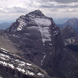
Photo: Tornado Mountain from the north (courtesy Allan Schierman)
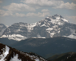
Looking south to Tornado Mountain from Isola Peak (courtesy Sonny Bou)
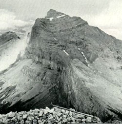
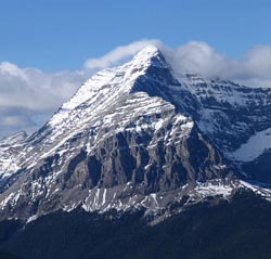
Looking north to Tornado Mountain (Interprovincial Boundary Survey Photo)
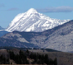
Photo: Looking west-northwest to Tornado Mountain from Highway #22 near the Oldman River Bridge
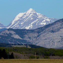
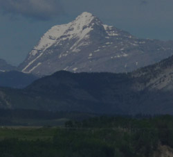
Photo: Looking west-northwest to Tornado Mountain from Highway #22 near the Oldman River Bridge
Looking west-northwest to Tornado Mountain from Sugarloaf Fire Lookout (courtesy Sonny Bou)
Looking west-northwest to Tornado Mountain from Highway #22 near the Oldman River Bridge
Looking west to Tornado Mountain from Sugarloaf Fire Lookout
Looking west beyond Sugarloaf to Tornado Mountain from the Livingstone Range (courtesy Sonny Bou)