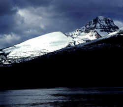
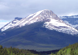
Photo: Looking south to Survey Peak from the Icefields Parkway (courtesy Gerry Hopkins)
Survey Peak
- 2667 m (8,750ft)
- First Ascent
- Naming History
51.9544N -116.850W
Located in the North Saskatchewan River Valley west of Howse River and north of Glacier Lake
Province: Alberta
Park: Banff
Headwater: Saskatchewan
Major Valley: Saskatchewan
Visible from Highway: 93N
Located in the North Saskatchewan River Valley west of Howse River and north of Glacier Lake
Province: Alberta
Park: Banff
Headwater: Saskatchewan
Major Valley: Saskatchewan
Visible from Highway: 93N
Ascent Date: 1898
Ascent Party: J. Norman Collie, H.E.M. Stutfield
Ascent Party: J. Norman Collie, H.E.M. Stutfield
Year Named: 1898
Named by: J. Norman Collie
Named for: Collie and Stutfield climbed the mountain in 1898 in order to conduct a plane table survey of the area.
Named by: J. Norman Collie
Named for: Collie and Stutfield climbed the mountain in 1898 in order to conduct a plane table survey of the area.
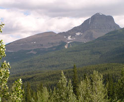
The forest on the eastern slopes of Survey Peak is of two slightly different colours. This indicates that part of the forest was burned off many decades ago and so is of a different age.
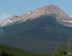
Photo: Looking west to Survey Peak from the Icefields Parkway at Saskatchewan River Crossing
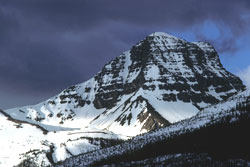
Looking south to the summit block of Survey Peak from the Icefields Parkway (courtesy Gerry Hopkins)
Looking south to Survey Peak from the Icefields Parkway
Looking west to Survey Peak from the Icefields Parkway at Saskatchewan River Crossing
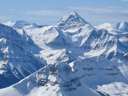
Looking south-southwest to Survey Peak (below in foreground) and Mount Forbes from Mount Wilson (courtesy Marta Wojnarowska)