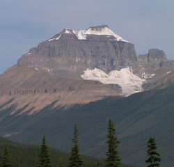
Photo: Looking west-northwest to Mount Saskatchewan from the Icefields Parkway (Lighthouse Tower rises above the ridge at right)
Mount Saskatchewan
- 3342 m (10,965ft)
- First Ascent
- Naming History
Located in the North Saskatchewan River Valley, north of Terrace Creek and the Alexandra River Valley
Province: Alberta
Park: Banff
Headwater: Saskatchewan
Major Valley: Saskatchewan
Ascent Party: W.S. Ladd, J. Monroe Thorington
Ascent Guide: Conrad Kain
Named by: J. Norman Collie
Named for: The name is taken from the Saskatchewan River whose headwaters is nearby.
In his book, "The Glittering Mountains of Canada," J. Monroe Thorington summed up appearance of Mount Saskatchewan to those travelling up the valley north of Saskatchewan River Crossing as follows, "Filling the great angle between Alexandra River and the North Fork, a thing of towers and battlements, rises Mount Saskatchewan. Formidable in appearance, and long sought by climbers, it had never failed to attract the attention of those who came into the region. A symmetrical monolith on the jagged northeast ridge is well known as the "Lighthouse" and serves as a landmark in the valley of the North Saskatchewan." Mount Saskatchewan's name is derived from its position near the headwaters of the Saskatchewan River. The upper cliffs of its southern face which we see from Alexandra River Flats, are almost always covered with snow. Its northern slopes features a large glacier. J. Monroe Thorington was a prominent mountaineer in the 1920's and 1930's and completed fifty two first ascents in the Rockies and Selkirks. He definitely had his eye on this peak when he rode up the valley in 1923. "We knew the mountain well by this time. From the east, on the slopes of Mount Coleman, we had gazed upon its unclimbed heights, wondering at its sheer forbidding face of snow-powdered cliff." With guide Conrad Kain and W.S. Ladd, Thorington completed the first ascent of this challenging peak and was, "satisfied beyond expression that we had been the first to ascend a mountain whose impressive and imposing architecture had for years excited our admiration." The northern cliffs and glaciers of Mount Saskatchewan may be seen from the roadside part way up the steep hill on the south side of Sunwapta Pass. The spectacular pinnacle known as Lighthouse Tower, or as it is sometimes called "Cleopatra's Needle," rises over 75 metres from a ridge which extends to the east of the highest part of Mount Saskatchewan. It may be seen from a pull-off 4.9 kilometres to the south of the Alexandra River Flats Viewpoint and this is also the best spot for a view of Mount Saskatchewan. Another view of the Tower is through a gap in the ridges 5.2 kilometres north of the viewpoint and although the spire is much closer and still spectacular, it is not nearly as "needle-like" as it is from the south. Lighthouse Tower was first climbed in 1964.
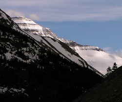
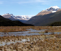
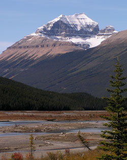
Photo: Looking south-southwest to Mount Saskatchewan from the Icefields Parkway on the Big Bend,
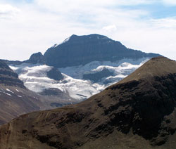
Looking south to Mount Saskatchewan from Parker Ridge
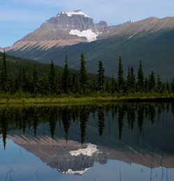
Looking west up the Alexandra River Valley to The Castelets (left) and Mount Saskatchewan (right) from the Icefields Parkway
Looking west-northwest to Mount Saskatchewan from the Icefields Parkway
Looking west-northwest to Mount Saskatchewan from the Icefields Parkway