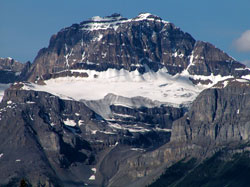
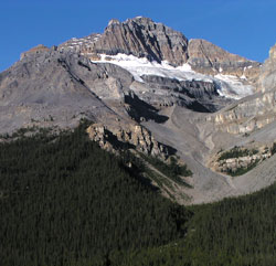
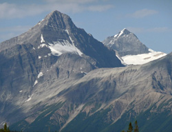
Photo: Looking west to Mount Sarbach from the Icefields Parkway
Mount Sarbach
- 3155 m (10,352ft)
- First Ascent
- Naming History
Located between the Mistaya River Valley and Howse River; above the confluence of the Howse and Saskatchewan Rivers
Province: Alberta
Park: Banff
Headwater: Saskatchewan
Major Valley: Mistaya
Visible from Highway: 93N
Ascent Party: J. Norman Collie, G.P. Baker
Ascent Guide: Peter Sarbach
Named by: J. Norman Collie
Named for: Sarbach, Peter (Peter Sarbach was the first of the Swiss guides to work in the Canadian Rockies.)
Peter Sarbach was the first of the Swiss guides. Norman Collie's first ascents of Mount Lefroy and Mount Victoria in 1897 were led by Sarbach who, later that summer, guided Collie's party to the summit of Mount Sarbach. The view of high, unclimbed peaks to the north inspired Norman Collie to return the following year and continue his explorations. The northern slopes of Mount Sarbach were the site of a fire lookout from 1943 until 1971. The structure was a wooden tower that supported a cupola. A cabin nearby served as a residence.
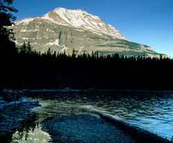
Photo: Looking southeast to Mount Sarbach from the east end of Glacier Lake (courtesy Gerry Hopkins)
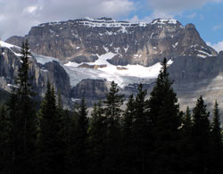
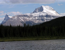
Looking north-northwest to Mount Sarbach from the Icefields Parkway
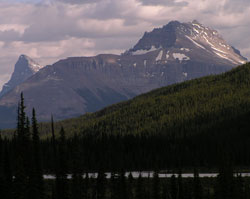
Looking northwest to Kaufmann Peaks (left) and Mount Sarbach from Lower Waterfowl Lake on Highway #93
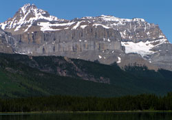
Mount Sarbach from the Icefields Parkway
Looking south-southwest to Mount Sarbach (Mount Chephren beyond at left) from the Icefields Parkway
Looking south-southwest to Mount Chephren (beyond at left) and Mount Sarbach from the Icefields Parkway
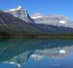
Looking northwest across Lower Waterfowl Lake to (l-r) Epaulette Mountain, Kaufmann Peaks, and Mount Sarbach (courtesy Rudolf Posch)
Looking southwest to Mount Outrum with Mount Forbes beyond at right