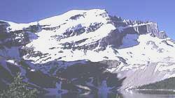
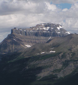
Photo: Looking southwest to Mount Richardson from Merlin Lake
Mount Richardson
- 3086 m (10,125ft)
- First Ascent
- Naming History
- Hiking and Trails
Located at the head of Merlin Valley and Corral Creek
Range: Slate
Province: Alberta
Park: Banff
Headwater: Bow
Visible from Highway: 1
Ascent Party: L.L. Delafield
Ascent Guide: Edward Feuz jr.
Named by: James Hector
Named for: Richardson, Sir John (John Richardson was Surgeon and naturalist on Franklin's Arctic expeditions of 1819 and 1825.)
Journal Reference: CAJ 4-142
Tex "Vernon" Woods wrote in the 1939 Skyline Hikers Bulletien that he had packed for two mountaineers in 1910 into the Ptarmigan Valley. From there they had made the first ascent of Mount Richardson and, "returned to camp so enthusiastic with the possibilities of further exploring the many hidden valleys and unnamed lakes seen from the peak, that we remained longer than had originally been intended. In fact until the 'grub stake' became uncomforably slender." ("Skoki" by Kathryn Manry) Arthur Coleman's book, "The Canadian Rockies -New and Old Trails," was published in 1912 and includes a photo with the caption, "Looking up Pipestone Valley from Mount Richardson" in the chapter describing his 1907 travels. Perhaps Coleman climbed the mountain prior to L.L. Delafield and Edward Feuz jr.
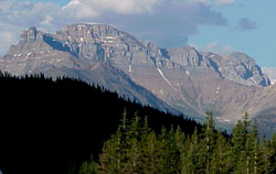
Photo: Looking east-northeast to Mount Richardson (left), Pika Peak, and Ptarmigan Peak from the Trans-Canada Highway near Kicking Horse Pass
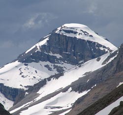
Looking northwest to Mount Richardson from Redoubt Mountain (courtesy Alan Kane)
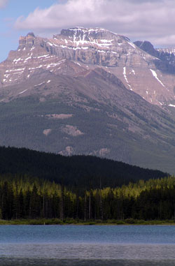
Looking east-northeast across Wapta Lake to Mount Richardson
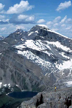
Looking northeast to Mount Richardson from Mount St. Piran
Looking west-northwest to Mount Richardson (courtesy Sonny Bou)