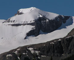
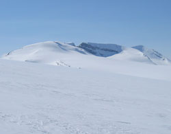
Photo: Looking southwest to the north summit of Mount Rhondda (now officially known as Mount Habel) from the Icefields Parkway
Mount Rhondda
- 3015 m (9,892ft)
- First Ascent
- Naming History
51.6447N -116.564W
Located on the continental divide the mountain is in the centre of the Wapta Icefield; 3 km southwest of Mount Thompson; one km northwest of Mount Rhondda
Province: Alberta/BC
Park: Banff/Yoho
Headwater: Saskatchewan/Columbia
Visible from Highway: 93N
Located on the continental divide the mountain is in the centre of the Wapta Icefield; 3 km southwest of Mount Thompson; one km northwest of Mount Rhondda
Province: Alberta/BC
Park: Banff/Yoho
Headwater: Saskatchewan/Columbia
Visible from Highway: 93N
Ascent Date: 1923
Ascent Party: A. Geoffrion, J.W.A. Hickson
Ascent Guide: Edward Feuz jr.
Ascent Party: A. Geoffrion, J.W.A. Hickson
Ascent Guide: Edward Feuz jr.
Year Named: 1917
Named by: Interprovincial Boundary Survey
Named for: Thomas, David Alfred First Viscount Baron Rhondda (David Thomas was a British parliamentarian who introduced an effective food rationing system in Britain during WW I.)
Named by: Interprovincial Boundary Survey
Named for: Thomas, David Alfred First Viscount Baron Rhondda (David Thomas was a British parliamentarian who introduced an effective food rationing system in Britain during WW I.)
Mount Rhondda is generally referred to as having a north summit and a south summit. The north summit is now officially known as Mount Habel.
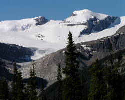
Photo: Mount Rhondda (at left) and Mount Habel and a portion of the Wapta Icefield above Peyto Glacier
Looking north-northwest to Mount Rhondda from the Iceline Trail (courtesy Vern De Wit)
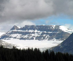
Looking northwest to Mount Rhondda (Mount Habel beyond) (courtesy Vern De Wit)
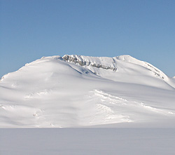
Looking northwest to Mount Rhondda (courtesy Marta Wojnarowska)