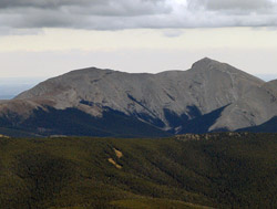
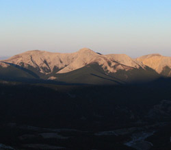
Looking east to Moose Mountain (courtesy Sonny Bou)
Moose Mountain
- 2437 m (7,996ft)
- Naming History
Located 19 km west of Bragg Creek; north of Canyon Creek and south of Coxhill Creek at the head of Ranger Creek
Province: Alberta
Park: Kananaskis
Headwater: Bow
Major Valley: Elbow
Visible from Highway: 1, 66
Named for: The mountain was named after the moose.
Because of its location significantly east of the main front range, Moose Mountain was a natural choice for an Alberta Forest Service fire lookout when the system was established in 1929. The current building was built in 1974 and is the third to occupy the site. The Moose Mountain Dome is a major geological structure that caused this mountain to rise up to the east of the main trend of the front ranges. It was also responsible for the creation of the Moose Mountain gas field to the east of the mountain. All of the front range mountains of the southern Alberta Rockies were formed by thrust faulting. However, in the case of Moose Mountain several thrust faults have occurred in close proximity to one another, resulting in a stacking of Paleozoic layers. A well drilled from the summit of the peak would encounter the top of the Paleozoic layer five times before finally reaching the Pre-Cambrian. An extensive cave system lies within the southern portion of the mountain. Called the Bragg Creek Ice Cave, its slit shaped entrance is located at the base of a cliff band above Canyon Creek. So far, experienced and well-equipped spelunkers have mapped over 500 metres of passageways. On August 12, 1858 Thomas Blakiston of the Palliser Expedition, ". . . left the main body of the exploring expedition at the site of Bow Fort. . ." and travelled to the southeast. In his report for the following day he wrote, ". . .our course still tending a good deal to the eastward, carried us farther from the mountains, but we passed within twelve miles of a marked outlier, which from its peculiar form, I called, 'The Family.'" Blakiston must have passed through the Bragg Creek/Priddis area and it appears that the mountain he was referring to is now known as Moose Mountain. *A hiking route to the summit is described in Gillean Daffern's Kananaskis Country Trail Guide.
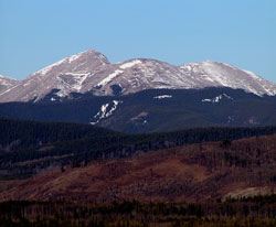
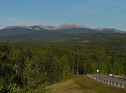
Looking west to Moose Mountain from Highway #22
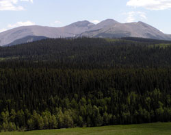
Photo: Looking southeast to Moose Mountain from Sibbald Flats
Looking west to Moose Mountain from Highway #22
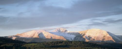
Photo: Looking southwest to sunrise on Moose Mountain from near Highway #68 (courtesy George Brindle)
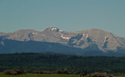
Looking west to Moose Mountain
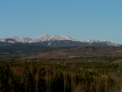
Looking southwest to Moose Mountain from the Trans-Canada Highway
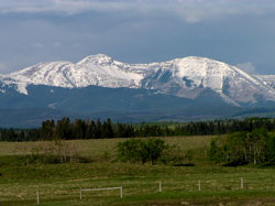
Looking southwest to Moose Mountain from the Trans-Canada Highway
Looking east-northeast to Moose Mountain (courtesy Sonny Bou)