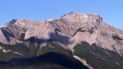
Photo: Mount McGillivray from the north on Highway #1A, just east of Exshaw
Mount McGillivray
- 2454 m (8,050ft)
- Naming History
Located Bow River Valley south of Lac des Arcs
Province: Alberta
Park: Kananaskis
Headwater: Bow
Major Valley: Bow
Visible from Highway: 1
Named for: McGillivray, Duncan (In 1800 Duncan McGillivray and David Thompson were the first white men to visit the Bow Valley.)
Duncan McGillivray was inspired by the explorations of Alexander Mackenzie who, although he travelled extensively following the Mackenzie River to the Arctic Ocean and travelling across the continent to the Pacific, had failed to find a navigable river which reached the Pacific Ocean. McGillivray was determined to find the source of the Columbia whose mouth was explored by Captain Vancouver's party in 1792. In November of 1800, McGillivray and David Thompson rode south from the recently established Rocky Mountain House. The mountains were, "everywhere covered with snow," and seemed to, "present an impenetrable bank." After passing the present site of the City of Calgary and travelling south to the Highwood River, they rode west up the Bow Valley as far as what is now Mount McGillivray. But it was late in the season and not practical to travel farther up the valley to search for a pass into the headwaters of the Columbia. After further explorations west of Rocky Mountain House McGillivaray returned to Rocky Mountain House for the remainder of the winter. In the spring, he was too ill with rheumatism to carry on his explorations and he returned to the East on crutches. Duncan McGillivray was highly regarded by David Thompson and others in the North West Company for whom they were exploring in 1800. Evidence of this is that on the map of western Canada which Thompson made following his travels he referred to all of the Rocky Mountains south of the Saskatchewan River as "Duncan's Mountains." [Additional Information: "Rocky Mountain House" by Fred Stenson]
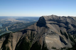
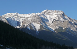
Photo: Looking northeast to Mount McGillivray from Pigeon Mountain (courtesy Rob Taerum)
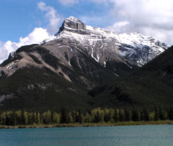
Looking southeast across Gap Lake to Mount McGillivray from Highway #1A
Looking southeast across Gap Lake to Mount McGillivray from Highway #1A
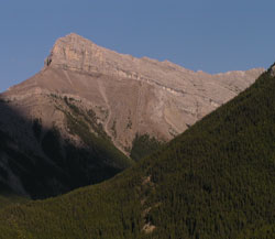
Photo: Looking southeast to Mount McGillivray from Highway #1A
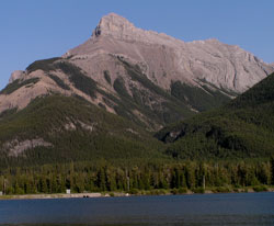
Looking southwest to Mount McGillivray from the Trans-Canada Highway