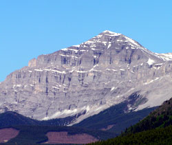
Photo: Looking up Etherington Creek to Baril Peak from Highway #940
Baril Peak
- 2998 m (9,836ft)
- First Ascent
- Naming History
Located on the continental divide at the head of Baril Creek and Henretta Creek
Range: High Rock
Province: Alberta/BC
Park: Kananaskis
Headwater: Bow/Kootenay
Visible from Highway: 40S
Ascent Party: Interprovincial Boundary Commission
Named for: Baril, Conrad M.L. (A native of Ottawa and member of the Surveyor General's staff, Conrad Baril was killed in action 9 November, 1915 while serving with the Canadian Engineers.)
The mountain is part of the High Rock Range and stands to the southeast of Fording Pass near the junction of Highways #40 and #940. Baril Peak is named for Conrad M.L. Baril of Ottawa, Ontario. He was a member of the Surveyor General's staff who was killed in action during WWI while serving with the Canadian Engineers. The mountain was first climbed in 1915 by members of the Interprovincial Boundary Commission.
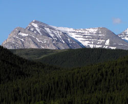
Photo: Baril Peak from the north on Highway #40 at Fitzsimmon's Creek
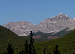
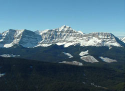
Looking up Etherington Creek to Baril Peak (right) and the high point between Mount Etherington and Baril Peak
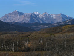
Looking southwest to (l-r) Baril Peak, Mount Cornwell, and Courcelette Peak from Highway #541
Looking west to Baril Peak from Raspberry Ridge (courtesy Ivan Pull)