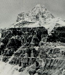
Photo: Lunette Peak (left) and Mount Assiniboine from the east (Photo from the Interprovincial Boundary Survey Report)
Lunette Peak
- 3398 m (11,150ft)
- First Ascent
- Naming History
- Hiking and Trails
50.8650N -115.649W
Located on the continental divide; a high point on the south arete of Mount Assiniboine
Province: Alberta/BC
Park: Banff/Assiniboine
Headwater: Bow/Kootenay
Visible from Highway: 742
Located on the continental divide; a high point on the south arete of Mount Assiniboine
Province: Alberta/BC
Park: Banff/Assiniboine
Headwater: Bow/Kootenay
Visible from Highway: 742
Ascent Date: 1901
Ascent Party: James Outram
Ascent Guide: C. Bohren, Christian Hasler sr.
Ascent Party: James Outram
Ascent Guide: C. Bohren, Christian Hasler sr.
Year Named: 1913
Named by: Interprovincial Boundary Survey
Named for: Unknown
Named by: Interprovincial Boundary Survey
Named for: Unknown
Popular Hike: Assiniboine
Journal Reference: App 10-47
Journal Reference: App 10-47
James Outram climbed the mountain in the mists while attempting to climb Mount Assiniboine. The next day he climbed Assiniboine.
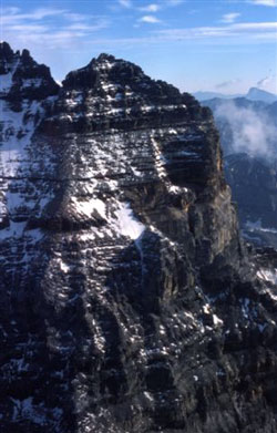
Photo: An airphoto taken looking northeast towards Lunette Peak (courtesy Glen Boles)