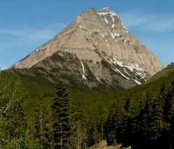
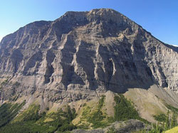
Photo: Looking west-northwest to Mount Lineham from the Cameron Lake Road. Note the Purcell Sill on the lower cliffs.
Mount Lineham
- 2728 m (8,950ft)
- Naming History
Located between Lineham Creek and Rowe Creek; southeast of Linham Lakes
Province: Alberta
Park: Waterton
Headwater: Oldman
Visible from Highway: 5
Named for: Lineham, John (A well-known pioneer of the Highwood area, John Lineham was involved in the Lumber, oil exploration, and agriculture industries. He was elected to the Territorial Legislative Assembly in 1888.)
This peak towers impressively over the road to Cameron Lake. The summit is less than three km from the road but the elevation difference is over 1100 metres. The east facing cliffs of Mount Lineham provide an excellent view of the Purcell Sill. This is a horizontal layer of greenish-black diabase that, while still molten, was squeezed between the sedimentary layers. Diabase is the coarse-grained equivalent of basalt.
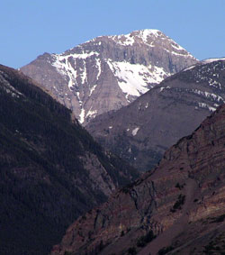
Photo: Looking west-southwest up Blakiston Creek and beyond Ruby Ridge to Mount Lineham from Highway #5
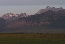
Looking west-southwest across Bellevue Hill to (l-r) Mount Lineham, Ruby Ridge, and Mount Blakiston
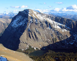
Looking south-southwest to Mount Lineham from near Mount Hawkins (courtesy Sonny Bou)
Looking south to Mount Lineham from Mount Blakiston (courtesy Vern De Wit)