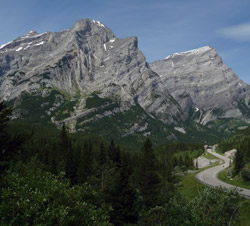
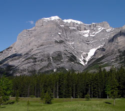
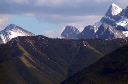
Looking north-northwest to Mount Kidd (both summits) from Highway #40
Mount Kidd
- 2958 m (9,705ft)
- First Ascent
- Naming History
Located between the Ribbon Creek Valley and the Kananaskis River; east buttress of Guinn''s Pass
Province: Alberta
Park: Kananaskis
Headwater: Bow
Major Valley: Kananaskis
Visible from Highway: 1, 40S
Ascent Party: R.C. Hind, J.F. Tarrant
Named by: D.B. Dowling (Dr. Dowling was an engineer in the Geological Survey of Canada)
Named for: Kidd, Fred (A resident of Morley, Fred Kidd outfitted expeditions which explored in the Kananaskis Valley.)
Mount Kidd is the Pilot Mountain of the Kananaskis Valley. George Dawson named Pilot Mountain in the Bow Valley between Banff and Castle Junction for its location on the outside of a major bend in the Bow Valley which made the peak visible for long distances up and down the valley. Mount Kidd is similarly situated, being visible from both the lower Kananaskis Valley and from the Kananaskis Lakes area to the south. The massive character of the mountain as well as its two separate peaks are best seen from the vicinity of Rocky Creek, 11.3 kilometres south of the Ribbon Creek Junction. From Rocky Creek, a spectacular fold down which a series of waterfalls flows may be seen. This feature marks the northern end of the Lewis Thrust Fault, a major geological marker which can be mapped to the south into the United States where it passes beneath Chief Mountain. From Kananaskis Village Junction we see only the northern peak of the mountain. The grassy slopes of the ridge to the right of the mountain was the former site of the Mount Kidd Fire Lookout. Constructed in 1981, it was the most recent addition in the series of fire lookouts first established in the late 1920''s to help protect Alberta''s forests from fires. It was last used in 1992 and removed in 1997. Funding cutbacks and the fact that the Kananaskis Emergency Services Building are situated immediately below the site contributed to its demise. The following information regarding the naming of the peak was received from John Kidd in correspondence received on 2011-08-04. John’s father was Fred Kidd and Stuart Kidd was John’s grandfather. Stuart Kidd had a brother named Fred Kidd. John was told by his father that the mountain was named after his uncle, Fred Kidd. Born near Ashton, Ontario, Fred Kidd homesteaded north of Calgary on the west branch of Nose Creek. According to his son, Fred could not resist the attraction of the mountains and so moved to Morley in 1907 where he operated the Scott and Leeson Trading Post and served as the Justice of the Peace. Part of his job was outfitting survey parties which worked in the Kananaskis Valley area. One of these was led by a geologist, D. Bogart Dowling (see Mount Bogart), who chose Kidd''s name for the mountain. John Kidd’s father spent four years in politics and it was during this time that the idea that Mount Kidd be named to honour his uncle Fred Kidd arose. Fred Kidd’s brother, Stuart Kidd, came west after Fred had settled in Alberta. In 1911 Martin Nordegg hired Kidd to be purchasing agent for Brazeau Coalieries in the North Saskatchewan valley. In 1914 he became general manager of Nordegg''s company-owned general store, the Bighorn Trading Company. He also became postmaster, justice of the peace, and the undertaker for the area. During this time he traded and worked with the Stoneys in the area and became fluent in the Stoney language. In 1927 he was made an honorary chief, probably the first white to be so honoured, and given the name of "Tah-Osa" which means "Moose Killer." He continued to live in the Nordegg area until 1939. [Additional information: "Small Moments in Time" by Anne (McMullen) Belliveau]
Looking north-northwest to Mount Kidd (north summit) from Highway #40
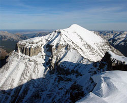
Looking northeast to the north summit of Mount Kidd from the south summit (courtesy Sonny Bou)
Looking south to Mount Kidd (courtesy Calvin Damen)
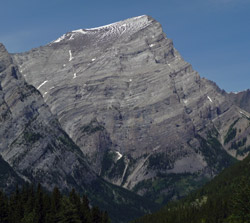
Looking west to the south summit of Mount Kidd
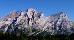
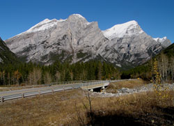
Photo: Looking north-northwest to Mount Kidd (both summits) from Rocky Creek Bridge on Highway #40
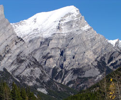
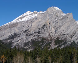
Looking north-northwest to the north summit of Mount Kidd from Highway #40
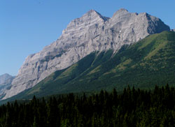
Photo: Looking southwest to the northern summit of Mount Kidd from Highway #40
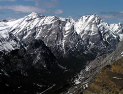
Photo: Looking north-northwest to Mount Kidd (both summits) from Opal Ridge
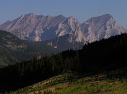
Photo: Looking north-northwest to Mount Kidd (both summits) from Highway #40
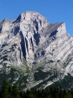
Photo: Looking north-northwest to the big fold on Mount Kidd from Highway #40
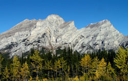
Photo: Looking north-northwest to Mount Kidd (both summits) from Rocky Creek Bridge on Highway #40
Looking southeast across Wind Ridge and between Mount Allan and Wind Mountain to Mount Kidd from the Trans-Canada Highway near the park boundary
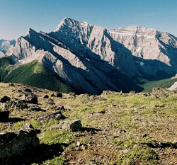
Looking north-northwest to the southern summit of Mount Kidd from Rocky Creek Bridge on Highway #40
Looking north-northwest to Mount Kidd (north summit) from Highway #40