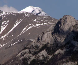
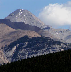
Photo: Looking northeast across the Palliser Range to the summit of Mount Aylmer from Highway #1 near Banff Townsite
Mount Aylmer
- 3162 m (10,375ft)
- First Ascent
- Naming History
Located in the Ghost River and Lake Minnewanka Valleys; east buttress of Aylmer Pass
Range: Palliser
Province: Alberta
Park: Ghost/Banff
Headwater: Bow
Visible from Highway: 1, 940N
Ascent Party: James J. McArthur
Named by: James J. McArthur
Named for: James McArthur, who completed the first ascent, was from Aylmer, Quebec.
Mount Aylmer is part of the Palliser Range. An impressive, pyramid shaped mountain when viewed from the east, it is almost two hundred metres higher than neighbouring Mount Costigan and often has snow cover when the nearby peaks are bare. With an elevation of 3162 metres it is the highest peak north of the Bow River for a considerable distance. From the Benchlands viewpoint, a good portion of the mountain is visible because we are looking directly up the valley of the Ghost River which takes a very direct route through thirteen kilometres of front range mountains. The mountain is also very prominent from Banff Townsite but only its smoothly curved summit rises beyond the Palliser Range.
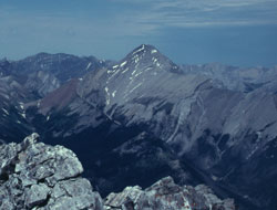
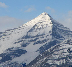
Photo: Mount Aylmer from the south on Mount Inglismaldie (courtesy Rienk Lakeman)
Looking north to Mount Aylmer from the old lookouts site on Aylmer Ridge (courtesy Sonny Bou)
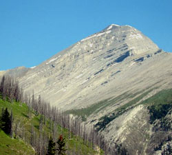
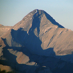
Looking west up the Ghost River Valley to Mount Aylmer from Benchlands on Highway #40
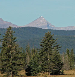
Looking north-northeast to Mount Aylmer from the Lake Minnewanka Loop Drive
Looking west to Mount Aylmer from Black Rock Mountain (courtesy Sonny Bou)
Looking north to Mount Aylmer (courtesy Sonny Bou)

Looking northeast to Mount Aylmer from Sanson Peak (courtesy Sonny Bou)

Looking west to Mount Aylmer from Devils Head (courtesy Sonny Bou)