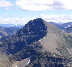
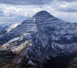
Photo: Looking southeast to Mount Haig from St. Eloi Mountain (courtesy Linda Breton)
Mount Haig
- 2610 m (8,563ft)
- Naming History
49.2892N -114.447W
Located on the continental divide at the head of Haig Creek; head of Cate Creek; head of Gravenstafel Brook
Range: Clark
Province: Alberta/BC
Headwater: Oldman/Flathead
Visible from Highway: 774
Located on the continental divide at the head of Haig Creek; head of Cate Creek; head of Gravenstafel Brook
Range: Clark
Province: Alberta/BC
Headwater: Oldman/Flathead
Visible from Highway: 774
Year Named: 1862
Named for: Haig, Captain R.W. (Captain Haig was the Chief Astronomer and Senior Military Officer for the British Boundary Commission (1858-1862) which surveyed the border from the Pacific to the Rockies.)
Named for: Haig, Captain R.W. (Captain Haig was the Chief Astronomer and Senior Military Officer for the British Boundary Commission (1858-1862) which surveyed the border from the Pacific to the Rockies.)
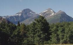
Photo: Mount Haig (left) and Gravenstafel Ridge (right) from the Castle River Road
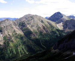
Photo: Looking southeast to Gravenstafel Ridge (left) and Mount Haig (beyond at right) from St. Eloi Mountain (courtesy Linda Breton)
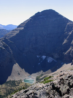
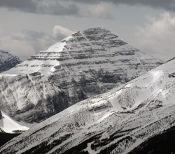
Photo: Looking south to Mount Haig from Gravenstafel Ridge (courtesy Linda Breton)
Looking southwest to Mount Haig from Southfork Mountain (courtesy Sonny Bou)
Looking southwest to Mount Haig from Carbondale Lookout (courtesy Sonny Bou)