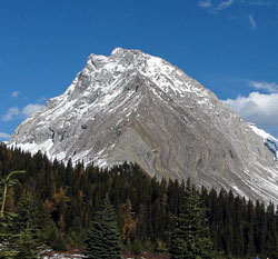
Photo: Looking northeast to Gusty Peak from near Chester Lake (courtesy Bennett Wong)
Gusty Peak
- 3000 m (9,843ft)
- First Ascent
- Naming History
50.8306N -115.259W
Located Kananaskis River andSmuts Creek Valleys between Mount Galatea and The Fortress
Range: Kananaskis
Province: Alberta
Park: Kananaskis
Headwater: Bow
Major Valley: Kananaskis
Visible from Highway: 40S
Located Kananaskis River andSmuts Creek Valleys between Mount Galatea and The Fortress
Range: Kananaskis
Province: Alberta
Park: Kananaskis
Headwater: Bow
Major Valley: Kananaskis
Visible from Highway: 40S
Ascent Date: 1972
Ascent Party: Glen Boles
Ascent Party: Glen Boles
Year Named: 1972
Named by: Glen Boles
Named for: The first ascent of this mountain was completed during extremely windy weather.
Named by: Glen Boles
Named for: The first ascent of this mountain was completed during extremely windy weather.
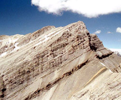
Looking southwest to Gusty Peak from Wedge Pond near Highway #40
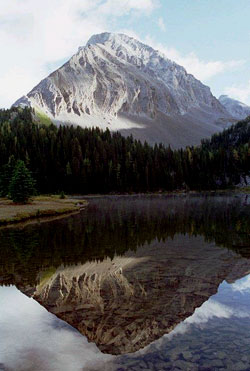
Photo: Looking northeast to Gusty Peak from near Chester Lake (courtesy Bennett Wong)
Gusty Peak (courtesy Bennett Wong)
Looking northeast to Gusty Peak from near Chester Lake (courtesy Sonny Bou)
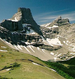
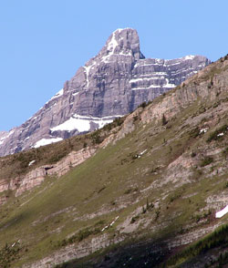
Looking west-southwest to The Fortress with Gusty Peak (beyond at right) (courtesy Calvin Damen)
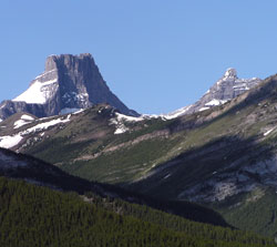
Looking southwest to The Fortress (left) and Gusty Peak from Wedge Pond near Highway #40
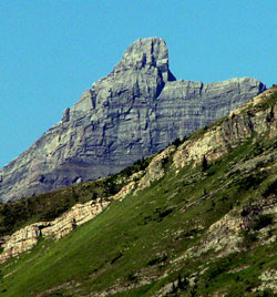
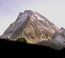
Photo: Gusty Peak from Highway #40 at Wedge Pond