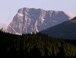
Photo: Looking up Brewster Creek to Fatigue Mountain from the Bow Valley Parkway, 2.4 km west of the junction with Highway #1
Fatigue Mountain
- 2959 m (9,708ft)
- First Ascent
- Naming History
51.0283N -115.693W
Located on the continental divide at the head of Howard Douglas Creek and Fatigue Creek; east Buttress of Citadel Pass
Province: Alberta/BC
Park: Banff/Assiniboine
Headwater: Bow/Kootenay
Visible from Highway: 1
Located on the continental divide at the head of Howard Douglas Creek and Fatigue Creek; east Buttress of Citadel Pass
Province: Alberta/BC
Park: Banff/Assiniboine
Headwater: Bow/Kootenay
Visible from Highway: 1
Ascent Date: 1888
Ascent Party: W.S Drewry.
Ascent Party: W.S Drewry.
Year Named: 1888
Named by: W.S. Drewry
Named for: The mountain was named after Mr. Drewry, a surveyor, became quite tired while completing the first ascent.
Named by: W.S. Drewry
Named for: The mountain was named after Mr. Drewry, a surveyor, became quite tired while completing the first ascent.
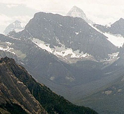
Photo: Looking south to Fatigue Mountain (Mount Assiniboine beyond) from Cory Pass (courtesy Calvin Damen)
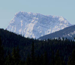
Photo: Looking up Brewster Creek to Fatigue Mountain from the Bow Valley Parkway, 2.4 km west of the junction with Highway #1
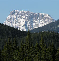
Looking up Brewster Creek to Fatigue Mountain from the Bow Valley Parkway, 2.4 km west of the junction with Highway #1