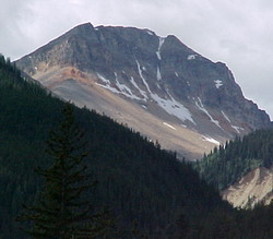
Photo: Mount Ernest Ross from 1.3 km east of Two O'Clock Creek on Highway #11
Mount Ernest Ross
- 2454 m (8,050ft)
- Naming History
Located in the North Saskatchewan River Valley west of the south end of Abraham Lake
Province: Alberta
Headwater: Saskatchewan
Major Valley: Saskatchewan
Visible from Highway: 11
Named for: Ross, Ernest (In 1940, Ernest Ross became the first person to drive from Rocky Mountain House to Saskatchewan River Crossing, twenty-eight years prior to the construction of a highway. He later worked for forty years to have the highway built.)
Ernest Ross began working to have a road built west of his home in Rocky Mountain House in 1928. Finally, in 1940, he became the first person to drive from Rocky Mountain House to Saskatchewan River Crossing, some twenty-eight years prior to the construction of a highway. His 1940 effort consisted of two vehicles and took ten days. In 1969, the year following the completion of the David Thompson Highway, the mountain was named to honour his efforts over a forty year period to have the highway completed. [Additional information: "Small Moments in Time" by Anne (McMullen) Belliveau]
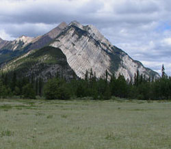
Looking north-northwest to Mount Ernest Ross from Kootenay Plains (courtesy Sonny Bou)
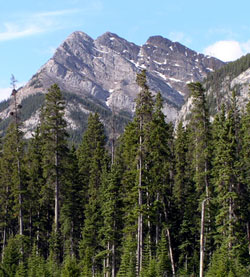
Looking south to Mount Ernest Ross from Highway #11