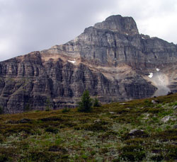
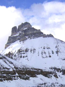
Looking west to Eiffel Peak from Larch Valley
Eiffel Peak
- 3084 m (10,119ft)
- First Ascent
- Naming History
- Hiking and Trails
Located between Paradise Creek and upper Moraine Lake Valley; head of Larch Valley; east buttress of Wastach Pass
Province: Alberta
Park: Banff
Headwater: Bow
Visible from Highway: 1
Ascent Party: Charles Thompson, G.M. Weed
Ascent Guide: Hans Kaufmann
Named by: Arthur Wheeler
Named for: A huge tower stands immediately north of the peak. It was though to be suggestive of the Eiffel Tower.
Journal Reference: App 10-89; AAJ 8-563
Eiffel Peak lies between the Moraine Lake valley and Paradise Valley. The slopes are gentle on the Moraine Lake side but the cliffs are steep and spectacular on the Paradise Valley side. A 120 metre notch separates the main summit from Eiffel Tower. Eiffel Peak can be ascended with little difficulty but Eiffel Tower is a challenge. It was not climbed until 1952 when J.A. Murphy and T.A. Mutch required nine hours to reach the top from the notch. A good, although somewhat disconcerting, viewpoint for both the peak and the tower is the Samson Mall in Lake Louse Village. Eiffel Peak, with Eiffel Tower to its right, appears beyond the steep cliffs of Mount Temple.
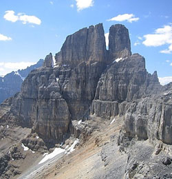
Photo: Looking southwest to Eiffel Peak (Eiffel Tower at left) from Pinnacle Peak (courtesy Mark Nugara)
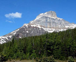
Looking sourth toEiffel Peak (left) and Eiffel Tower from the Trans-Canada Highway, just west of Lake Louise
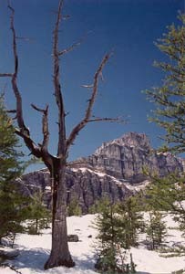
Photo: Looking northwest to Eiffel Peak from Larch Valley (courtesy David Wasserman)
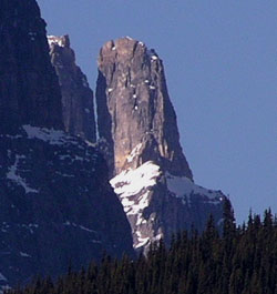
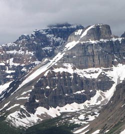
Looking northeast to Eiffel Tower (left) and Eiffel Peak (courtesy John Duerden)
Looking northwest to Eiffel Peak from Larch Valley (courtesy Sonny Bou)
Looking west-northwest to Eiffel Peak from Panorama Ridge (courtesy Sonny Bou)