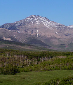
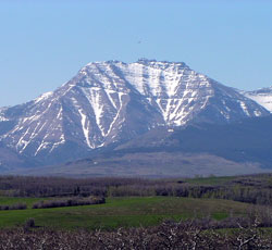
Looking west-southwest to Mount Dungarvan
Mount Dungarvan
- 2575 m (8,450ft)
- Naming History
Located at the head of Dungarvan Creek; north of Blakiston Creek
Province: Alberta
Park: Waterton
Headwater: Oldman
Visible from Highway: 6, Red Rock Canyon Road
Named for: Dungarvan is the Irish term for a rough and broken mountain. It is also the name of a seaport in County Waterford, Ireland.
Mount Dungarvan lies some four kilometres north of Mt. Galwey. A much more massive peak, it rises to 2566 m. Dungarvan is the Irish term for a rough and broken mountain. It is also the name of a seaport in County Waterford, Ireland. The mountain consists of a series of pinnacles made from basalt of the Purcell Sill (a sill is a layer of igneous rock which was forced between layers of sedimentary rock and then cooled and solidified). Whether the mountain is named because it is a "rough and broken" mountain or in honour of the Irish seaport is not known, however the summit ridge, when viewed from the northeast, is made up of a number of small, broken segments.
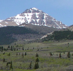
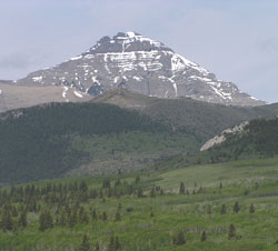
Looking west to Mount Dungarvan
Mount Dungarvan (left) and Cloudy Ridge (right) from west of Highway #6
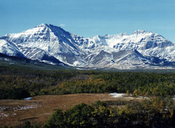
(l-r) Mount Dungarvan, Mount Glendowan, and Cloudy Ridge
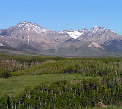
Looking south-southwest to Mount Dungarvan
Looking west to Mount Dungarvan