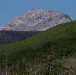
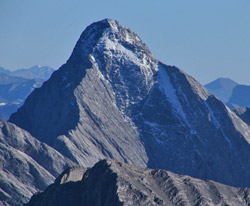
Photo: Looking west to Mount Darrah from the Carbondale River Valley
Mount Darrah
- 2755 m (9,039ft)
- First Ascent
- Naming History
Located on the continental divide at the head of Goat Creek and the head of Corbin Creek
Range: Flathead
Province: Alberta/BC
Headwater: Oldman/Flathead
Ascent Party: Interprovincial Boundary Commission
Named for: Darrah, Captain (Captain Darrah was the astronomer attached to the British Boundary Commission which delineated the border from the Pacific to the Rockies.)
The mountain is shown as "Gable Mountain" in the Interprovincial Boundary Survey Atlas. It was likely remamed because of the existance of another Gable Mountain in the Red Deer River Valley. In the lower of the two photos, the two triangular, light-coloured rocks are part of the Peechee Reefs (Peechee Formation) of the Upper Devonian. In the upper left corner of the photo is the Palliser Formation. The Devonian succession here sits on a thin panel of Cambrian rocks which overlie a fault. [Ian Halladay]
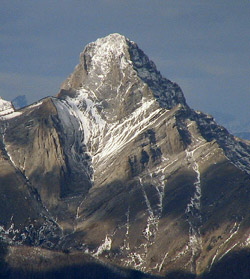
Looking northwest to Mount Darrah from Southfork Mountain (courtesy Sonny Bou)
Looking west to Mount Darrah (right) from the Carbondale River Valley
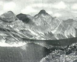
Photo: Looking southeast to Mount Darrah (Interprovincial Boundary Report photo)
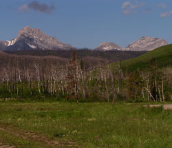
Looking south-southeast to Mount Darrah from Mount Ptolemy (courtesy Sonny Bou)
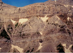
This wonderful exposure of a reef is located on the east-facing cliffs of the Flathead Range, just south of Mount Darrah.

Looking west to Mount Darrah from Carbondale Lookout (courtesy Sonny Bou)