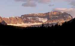
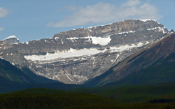
Photo: Looking northwest to Mount Daly from Highway #1 west of Lake Louise
Mount Daly
- 3152 m (10,342ft)
- First Ascent
- Naming History
Located on the continental divide west of Bath Glacier and east of Waputik Icefield
Province: Alberta/BC
Park: Banff/Yoho
Headwater: Bow/Columbia
Visible from Highway: 1, 93N
Ascent Party: J.H. Batcheller, C.E. Fay, E. Tewes
Ascent Guide: Christian Hasler sr., C. Bohren
Named by: Charles E. Fay
Named for: Daly, Charles P. (Charles Daly was the President of the American Geographical Society)
When viewed from the east as one approaches Lake Louise on the Trans-Canada Highway, Mount Daly appears as a long, high ridge with Bath Glacier below the cliffs. Bath Glacier is the southernmost extent of what is a nearly continuous series of icefields and glaciers that stretch north almost to Jasper townsite. Charles Fay named the mountain in 1898 and then went on to complete the first ascent five years later.
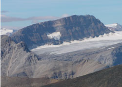
Looking northwest to Mount Daly from Fairview Mountain
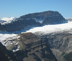
Looking northwest to Mount Balfour (beyond) and Mount Daly from Mount Bosworth (courtesy Sonny Bou)
Looking south along the east-facing cliffs of Mount Daly (courtesy Sonny Bou)
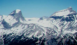
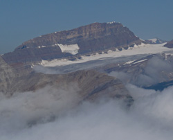
Photo: Looking north toMount Niles (left) and Mount Daly (courtesy Alan Kane)

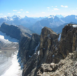
Looking east to Mount Daly from the Iceline Trail
Looking northwest to Mount Daly (Mount Niles beyond at left)
Looking northwest to Mount Daly from Mount St. Piran