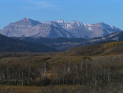
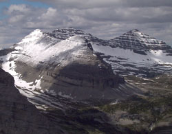
Photo: Looking southwest to (l-r) Baril Peak, Mount Cornwell, and Courcelette Peak from Highway #541
Courcelette Peak
- 3044 m (9,987ft)
- First Ascent
- Naming History
Located between Fording River and the Henretta Creek headwaters; southern buttress of Fording Pass
Range: High Rock
Province: BC
Headwater: Kootenay
Visible from Highway: 40S, 541
Ascent Party: Interprovincial Boundary Commission
Named by: Interprovincial Boundary Survey
Named for: Courcelette was a town in France which saw heavy fighting during WW I.
Mount Cornwell and the peaks of Mount Courcelette exhibit distinctive horizontal bedding planes which are often highlighted by snow. Since all of the peaks in this group are considerably higher than others they often have snow cover. The horizontal bedding is highlighted under these conditions. Lying entirely in British Columbia beyond the Continental Divide, Mount Courcelette is the highest mountain of the High Rock Range with the exception of Tornado Mountain some thirty-eight kilometres to the south. The mountain is, to some extent, a small range with six distinct high points along its six kilometre length. The Interprovincial Boundary Survey ascended the mountain on September 26, 1915, taking photos from the summit of their surveying purposes. COURCELETTE AND THE BATTLE OF THE SOMME Courcelette is a village in France which was the scene of heavy fighting by Canadian Forces during the Battle of the Somme. It was said that, "...no other battlefield in the Great War witnessed more killing per square yard" than the Somme. The day that the battle began, July 1, 1916, proved to be a disaster unequalled in the annals of British military history -some 57,500 men killed, wounded, or missing in just a few short hours. Courcelette was attacked by the Canadian Corps on September 15th. Seven of the newly-invented British tanks were allocated to the front and played an important role. German regimental histories recorded, "The arrival of the tanks on the scene had the most shattering effect on the men. They felt quite powerless against these monsters which crawled along the top of the trench enfilading it with continuous machine-gun fire..." One of the tanks managed to reach the edge of Courcelette where a sunken road defended by numerous machine guns blocked progress. The Canadians were said to have, "moved through a welter of dead and dying men to sweep in clear with the bayonet," and later that day captured Courcelette. There were eleven counter-attacks the next day but the prize was held. When the Battle of the Somme ended on November 24th it had cost the Canadian Corps 24,029 men. In total the British lost an astonishing 600,000; the French 180,000; and the Germans 300,000. When this distinctive, multi-peaked mountain was being mapped by the Interprovincial Boundary Survey in 1918, the sacrifices of the Canadian Regiments which fought in the Battle of the Somme were honoured.
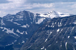
Photo: Looking southwest to Courcelette Peak from Holy Cross Mountain
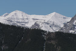
Looking southwest to Courcelette Peak from Cat Creek Hills
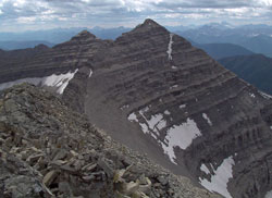
Looking south-southwest along the peaks of Courcelette Peak (courtesy Allan Schierman)
(courtesy Allan Schierman)
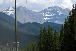
Looking southeast to Courcelette Peak from the Elk Valley Road
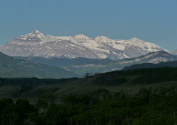
Photo: Looking southwest to (l-r) Baril Peak, Mount Cornwell, and Courcelette Peak from Highway #541