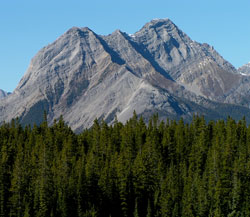
Photo: Looking west-southwest to Cone Mountain from the Smith-Dorrien Road at Rummel Creek
Cone Mountain
- 2910 m (9,548ft)
- Naming History
- Hiking and Trails
50.8900N -115.463W
Located at the west end of Spray Lakes Reservoir between Bryant Creek and Turbulent Creek
Range: Sundance
Province: Alberta
Park: Banff
Headwater: Bow
Visible from Highway: 742
Located at the west end of Spray Lakes Reservoir between Bryant Creek and Turbulent Creek
Range: Sundance
Province: Alberta
Park: Banff
Headwater: Bow
Visible from Highway: 742
Year Named: 1915
Named for: The name refers to the mountain's profile as seen from the Spray River Valley. The peak is visible directly at the end of the valley to those travelling downstream towards Spray Lakes Reservoir.
Named for: The name refers to the mountain's profile as seen from the Spray River Valley. The peak is visible directly at the end of the valley to those travelling downstream towards Spray Lakes Reservoir.
Popular Hike: Assiniboine
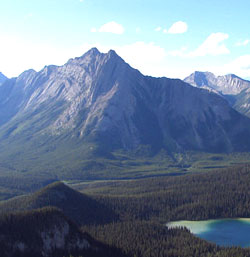
Photo: Looking north-northwest to Cone Mountain from Mount Shark (courtesy Sonny Bou)