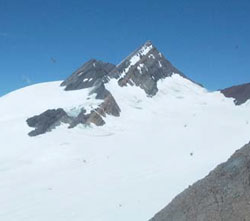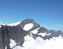
Photo: Chaba Peak (courtesy Brad Harrison)
Chaba Peak
- 3212 m (10,539ft)
- First Ascent
- Naming History
52.1978N -117.672W
Located on the continental divide in the upper Athabasca River Valley southeast of Chaba Glacier
Province: Alberta/BC
Park: Jasper
Headwater: Athabasca/Columbia
Major Valley: Athabasca
Located on the continental divide in the upper Athabasca River Valley southeast of Chaba Glacier
Province: Alberta/BC
Park: Jasper
Headwater: Athabasca/Columbia
Major Valley: Athabasca
Ascent Date: 1928
Ascent Party: E. Schoeller,
Ascent Guide: J. Rahmi
Ascent Party: E. Schoeller,
Ascent Guide: J. Rahmi
Year Named: 1920
Named by: Interprovincial Boundary Survey
Named for: Coleman named the Chaba River (Stoney Indian for beaver). In 1902 Jean Habel applied the name to a peak two km NE of the currently named Chaba Mountain. The Interprovincial Boundary Survey subsequently "moved" the name to the current Chaba Mtn.
Named by: Interprovincial Boundary Survey
Named for: Coleman named the Chaba River (Stoney Indian for beaver). In 1902 Jean Habel applied the name to a peak two km NE of the currently named Chaba Mountain. The Interprovincial Boundary Survey subsequently "moved" the name to the current Chaba Mtn.
The mountain has also been referred to as Pimple Mountain because of its shape when viewed from some angles.
