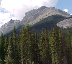
Photo: Mount Burstall from the Smith Dorrien Road near Mud Lake
Mount Burstall
- 2760 m (9,056ft)
- First Ascent
- Naming History
50.7703N -115.326W
Located in the Smith-Dorrien Creek Valley, south of Burstall Lakes, and west of French Creek
Range: Spray
Province: Alberta
Park: Kananaskis
Headwater: Bow
Visible from Highway: 742
Located in the Smith-Dorrien Creek Valley, south of Burstall Lakes, and west of French Creek
Range: Spray
Province: Alberta
Park: Kananaskis
Headwater: Bow
Visible from Highway: 742
Ascent Date: 1972
Ascent Party: M. Brown, I. Carruthers, C. Cobb, B.E. Seyforth
Ascent Guide: Bernie Schiesser
Ascent Party: M. Brown, I. Carruthers, C. Cobb, B.E. Seyforth
Ascent Guide: Bernie Schiesser
Year Named: 1918
Named for: Burstall, Lt. General Sir E.H. (Lt. General Burstall was the Commander of Canadian troops during WW I.)
Named for: Burstall, Lt. General Sir E.H. (Lt. General Burstall was the Commander of Canadian troops during WW I.)