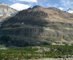
Photo: Looking east to Mount Yukness (courtesy Kathy and Rob Taerum)
Mount Yukness
- 2847 m (9,341ft)
- Naming History
- Hiking and Trails
Located at the head of Cataract Brook immediately southeast of Lake O'Hara; between Opabin Valley and Lake Oesa
Province: BC
Park: Yoho
Headwater: Columbia
Named for: "Yukness" is the Stoney Indian word for "sharpened with a knife." The peak appears to be when viewed from Lake O'Hara.
Describing his first view of Lake O'Hara, Walter Wilcox wrote, "Soon we came upon the western end of as beautiful a lake as I have ever seen. While showing neither glaciers nor snow upon the immediate peaks, the immense walls to the left and the cliffs and ideally pyramidal peak to he right (Mount Yukness) formed a foreground of wonderful grandeur. The northwest end on which we stood fringed the emerald water with a growth of pine. The south east end facing us was encircled with cliffs five hundred feet in height, from whose summit, piled high with the rocks of an old moraine, three slender waterfalls leaped into the lake. This lake, about a mile in length and slightly less in width, I have known as Lake O'Hara. Ascending the cliffs upon our left by a gully we reached the glacial dam. The bed of an ancient glacier behind this is occupied by a very small lake, at the base of the sharp peak of which I spoke, and which I called by the Indian equivalent, Yukness." [Eternal Lake O'Hara by Carol Ann Sokoloff]
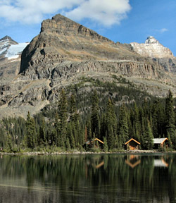
Looking southeast across Lake O'Hara to Mount Yukness (courtesy Brenda Everitt)
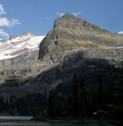
Photo: Mount Yukness from Lake O'Hara