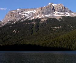
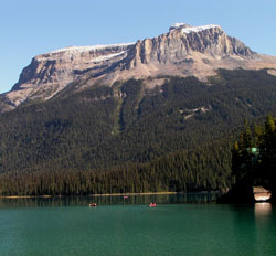
Photo: Looking east to Wapta Mountain from Emerald Lake
Wapta Mountain
- 2778 m (9,115ft)
- First Ascent
- Naming History
- Hiking and Trails
Located between Emerald Lake and the Yoho Valley; the northern end of Fossil Ridge; southern buttress of Yoho Pass
Province: BC
Park: Yoho
Headwater: Columbia
Visible from Highway: 1
Ascent Party: James Outram, J.H. Scattergood
Ascent Guide: C. Bohren
Named by: Otto Koltz
Named for: Klotz named the river which had been named "Kicking Horse," Wapta which means "running water." James Hector's name prevailed but the name Wapta was applied to this mountain which overlooks the River.
Journal Reference: App-1085
Lying immediately north of the ridge which contains the Burgess Shale fossil beds, it is one of the mountains which forms the backdrop to Emerald Lake. In summer the slopes below the eastern cliffs of Wapta Mountain are a bright green. Snow slides keep them bare of trees and the huge avalanche paths which descend into the Yoho Valley from Wapta Mountain leave piles of snow next to the road until mid August. The highlight of Dr. Charles D. Walcott's career occurred in 1909 high above Emerald Lake as he rode below the long ridge connecting Wapta Mountain with Mount Field. A block of shale had tumbled down the slope to the trail and was blocking the trail. Walcott dismounted and was about to tip the slab out of the way but instead reached for his rock hammer and split the slab open. The fossils in this slab and thousands of others from the Burgess Shale formation have challenged the skills and imaginations of palaeontologists ever since. The following year Walcott returned to the area accompanied by his sons Stuart (see Stuart Knob) and Sidney. Together they examined all the layers on the ridge above the point where the fossil laden rock had been found, eventually finding the fossiliferous band. For the next thirty days they quarried the shale and slid samples down the ridge to the trail where they were loaded onto pack horses and made their way to the CPR station at Field. Eventually some 65 000 specimens on 30 000 slabs of rock were delivered to the Smithsonian Institute.
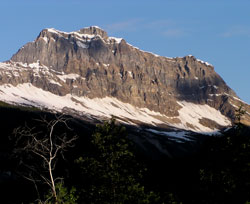
Photo: Looking northwest to Wapta Mountain from the Spiral Tunnels Viewpoint on the Trans-Canada Highway
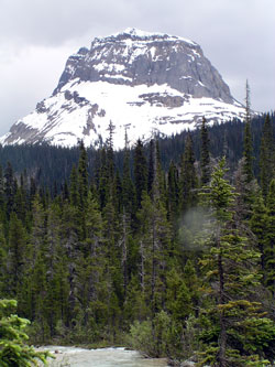
Looking south to Wapta Mountain from near Takakkaw Falls
Looking south to Wapta Mountain from Yoho Lake
Looking east to Wapta Mountain from Emerald Lake
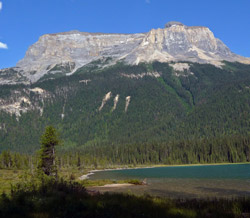
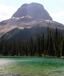
Looking east across Emerald Lake to Wapta Mountain
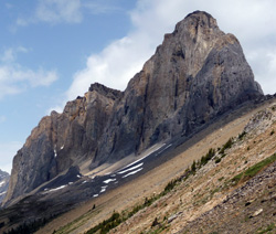
Looking north to Wapta Mountain