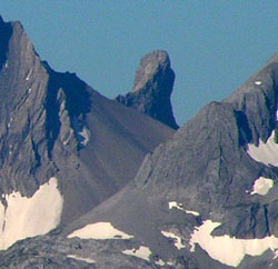
Photo: Waka Nambe from the northeast at the old Elpoca Creek Bridge on Valleyview Trail
Waka Nambe
- 2880 m (9,450ft)
50.5667N -115.244W
Located east of Joffre Creek, 700 metres west of Warrior Mountain
Province: BC
Headwater: Kootenay
Visible from Highway: 40S
Located east of Joffre Creek, 700 metres west of Warrior Mountain
Province: BC
Headwater: Kootenay
Visible from Highway: 40S
Waka Nambe, a small but spectacular tower-like feature, is located just west of Warrior Mountain. The name is an Indian word meaning "Great Spirit Thumb" or "Hand of God" and is a refreshing break from the World War I era names of its neighbouring peaks. It is clearly visible from Highway #40 in the vicinity of Kananaskis Lakes and from the upper lake.
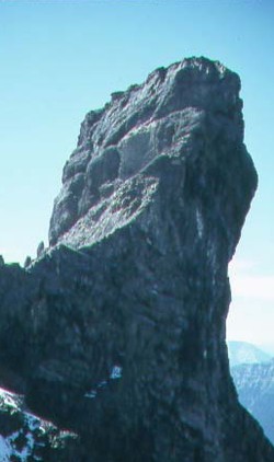
Photo: Waka Nambe from the northeast (courtesy Alan Kane)
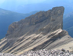
Looking west to Waka Nambe from Warrior Mountain (courtesy Sonny Bou)
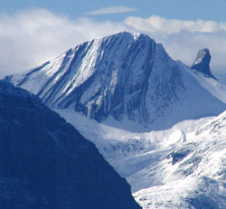
Looking southwest to Warrior Mountain (Waka Nambe beyond at right) from Tombstone Mountain (courtesy Sonny Bou)