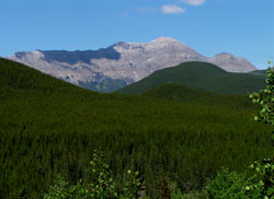
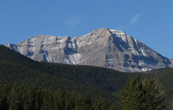
Photo: Bluerock Mountain from east on Highway # 546 in the Sheep River Valley
Bluerock Mountain
- 2789 m (9,150ft)
- Naming History
Located north of Bluerock Creek and west of Gorge Creek
Province: Alberta
Park: Kananaskis
Headwater: Bow
Visible from Highway: 546
Named for: Bluerock Mountain's name is probably based on the fact that mountains like Bluerock, which are closer to a viewer on the prairies, appear darker or bluer than more distant peaks.
Threepoint Mountain, Mount Rose, and Bluerock Mountain make up a small range which forms the front range between the Elbow River and the Sheep River. These mountains are separated from Cougar Mountain and Mount Burns to the southwest by the valley of Cougar Creek which joins the Elbow River to the northwest of Threepoint Mountain. Bluerock Mountain is easily recognized from the prairies, partly because it lies about five km to the east of the main fromt range. It features a long east-facing escarpment that from the summit stretches a considerable distance to the south befoe descending into the low forested hills. Because Bluerock is closer to a viewer on the prairies, it appears a darker blue than more distant peaks. *A hiking route to the summit is described in Gillean Daffern?s Kananaskis Country Trail Guide.
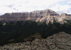
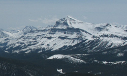
Photo: Looking west to Bluerock Mountain from Mount Ware
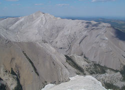
Looking north to Bluerock Mountain (courtesy Allan Schierman)
Looking west-southwest to Bluerock Mountain from Volcano Ridge (courtesy Sonny Bou)
Looking west-southwest to Bluerock Mountain from Volcano Ridge (courtesy Sonny Bou)
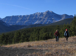
Looking southwest to Bluerock Mountain (courtesy Sonny Bou)