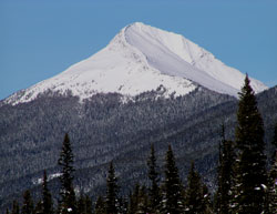
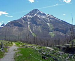
Photo: Looking north to Vermilion Peak from Highway #93(S)
Vermilion Peak
- 2636 m (8,650ft)
Located in the Vermilion River Valley across Haffner Creek from Mount Stanley
Province: BC
Park: Kootenay
Headwater: Kootenay
Major Valley: Vermilion
Visible from Highway: 93S
Four hours after crossing Vermilion Pass, James Hector's party reached the Vermilion Plain where Ochre Creek joins the main valley. He wrote in his journal that, "Its surface is completely covered with yellow ochre, washed down from the ferruginous shales in the mountains. The Kootanie Indians come to this place sometimes, and we found the remains of a camp and of a large fire which they had used to convert the ochre into the red oxide which they take away to trade to the Indians of the low country, and also to the Blackfoot as a pigment, calling it vermilion." The attractive peak which stands to the east of the ochre beds takes its name from the colour of the pigment which the Indians obtained in the flats below. When the Interprovincial Boundary Survey studied the pass, "the extensive remains of old teepee poles in the vicinity" were still visible. For a panoramic view from the summit of Vermilion Peak visit www.canadasmountains.com.
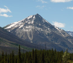
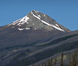
Photo: Looking south-southwest to Vermilion Peak from Highway 93(S)
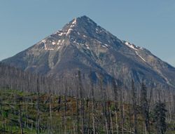
Looking southwest to Vermilion Peak from Highway #93(S)
Looking west to Vermilion Peak (Goodsir Towers at right) from the northwest ridge of Stanley Peak (courtesy Paul Russell)
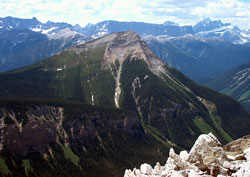
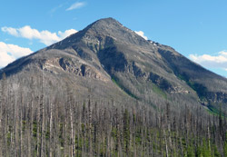
Looking southwest to Vermilion Peak from the Marble Canyon Trail
Looking north to Vermilion Peak from Highway #93(S)
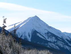
Looking south-southwest to Vermilion Peak from Highway #93(S) near Vermilion Pass
Looking south-southwest to Vermilion Peak