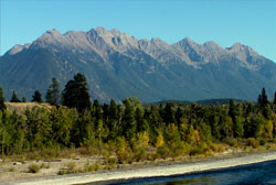
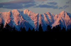
Photo: Looking southeast to The Steeples from Highway #93 at Fort Steele
The Steeples
- 2641 m (8,665ft)
- Naming History
Located in the Kootenay River Valley, west of the Bull River
Range: Hughes
Province: BC
Headwater: Kootenay
Major Valley: Kootenay
Visible from Highway: 93SS
Named by: Thomas Blakiston
Named for: Presumably the mountain was thought to resemble a number of church steeples.
Five kilometres in length,The Steeples form the southern end of the Hughes Range that lies to the east of the Kootenay Valley from east of Columbia Lake to the Bull River that enters the Kootenay at the town of Bull River. The peak at the southern end of The Steeples is known as Bull MountainThomas Blakiston of the Palliser Expedition wrote of naming The Steeples in August, 1858, "I also obtained a sketch of the mountains to the northward, Mount Deception, or, as I had myself named it from its peculiar form, "The Steeples," standing quite distinct from the rest. It is not clear what Blakison meant by his reference to Mount Deception but it appears he chose to re-name it and labelled the point as "The Steeples" on his sketch map. However Palliser named the feature Deception Mountain on his 1865 map. Blakiston also seems to be referring to the same feature as Mount Sabine when he wrote, ". . .stretching from Mount Sabine on the north southward to the southward of the boundary line. . ."
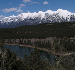
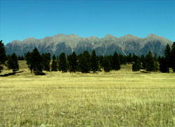
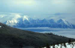
Photo: Looking northeast to The Steeples from Highway #3
Looking east to The Steeples from Highway #3
Looking east to The Steeples from Highway #93
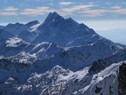
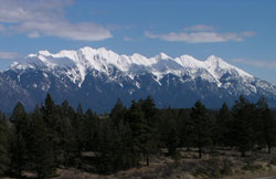
Looking south to The Steeples from Mount Fisher (courtesy Sonny Bou)
The Steeples (courtesy Dan Mills)
The Steeples (courtesy Dan Mills)