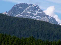
Photo: Looking to southwest to Phillips Peak from Elkford
Phillips Peak
- 2911 m (9,550ft)
- Naming History
Located beween the Elk River Valley and the Bull River Valley at the head of Brule Creek; 11 km southwest of Elkford
Province: BC
Headwater: Kootenay
Named for: Phillips, J.M. (A Game Commissioner from Pennsylvania, Mr. Phillips completed the map in W.T. Hornaday's book, "Campfires in the Canadian Rockies," which described a trip taken in 1905.)
Please note that there is Phillips Peak in southeastern BC near the Elk Valley, Phillipps Peak near Crowsnest Pass, and Mount Phillips near Mount Robson. Ted Moser reports that, "It's a huge, awesome mountain, with a high cirque lake and a ribbon falls plunging down a cliff from it. Best of all, the west face of the mountain that displays all this takes some heavy bushwhacking to reach, so when you get there you know you're one of a relatively few people who have seen it.
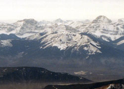
Looking west-southwest to Mount Vanbuskirk (left) and Phillips Peak from Mount Lyall (courtesy Allan Schierman)
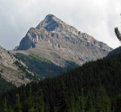
Looking west-southwest to Phillips Peak from the Elk Valley (courtesy Katy Drijber)
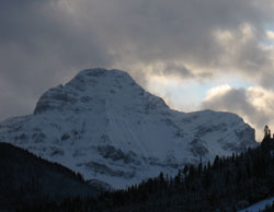
Looking southeast to Phillips Peak (courtesy Allan Schierman)